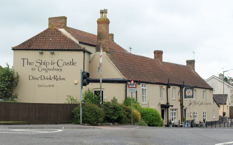
Latitude: 51.3707 / 51°22'14"N
Longitude: -2.8094 / 2°48'33"W
OS Eastings: 343753
OS Northings: 163825
OS Grid: ST437638
Mapcode National: GBR JF.SXQM
Mapcode Global: VH7CG.8T43
Plus Code: 9C3V95CR+76
Entry Name: The Congresbury Arms
Listing Date: 9 February 1961
Grade: II
Source: Historic England
Source ID: 1158076
English Heritage Legacy ID: 33971
ID on this website: 101158076
Location: Congresbury, North Somerset, BS49
County: North Somerset
Civil Parish: Congresbury
Built-Up Area: Congresbury
Traditional County: Somerset
Lieutenancy Area (Ceremonial County): Somerset
Tagged with: Inn
This list entry was subject to a Minor Amendment on 20 February 2025 to amend the name and address and reformat the text to current standards.
ST 46 SW
4/104
CONGRESBURY C.P.
HIGH STREET (east side)
The Congresbury Arms
(Formerly listed as Ship and Castle Inn)
9.2.61
G.V.
II
Inn. Early C18 with C19 alterations. Colourwashed render with double Roman tile roof to roadside range, pantiles to rear additions. Long two-storey, six-window range to road with scattered casement fenestration and two doorways: that to left-hand with flat hood on carved brackets with two-leaf plank door, that to right-hand with single leaf plank door. Parallel two-storey, two-window wing at rear with higher roof level and splayed wing to the north with hipped roof. Rear ranges have twelve- and sixteen-pane sash fenestration.
Interior: some chamfered beams.
The inn forms a group with the Village Cross (q.v.).
Listing NGR: ST4375363825
External links are from the relevant listing authority and, where applicable, Wikidata. Wikidata IDs may be related buildings as well as this specific building. If you want to add or update a link, you will need to do so by editing the Wikidata entry.


Other nearby listed buildings