Latitude: 51.9831 / 51°58'59"N
Longitude: -0.5942 / 0°35'38"W
OS Eastings: 496644
OS Northings: 232559
OS Grid: SP966325
Mapcode National: GBR F2F.LLY
Mapcode Global: VHFQY.NF73
Plus Code: 9C3XXCM4+68
Entry Name: North Stableblock Approximately 100 Metres East of Woburn Abbey
Listing Date: 23 January 1961
Grade: I
Source: Historic England
Source ID: 1158192
English Heritage Legacy ID: 38256
ID on this website: 101158192
Location: Central Bedfordshire, MK17
County: Central Bedfordshire
Civil Parish: Woburn
Traditional County: Bedfordshire
Lieutenancy Area (Ceremonial County): Bedfordshire
Church of England Parish: Woburn
Church of England Diocese: St.Albans
Tagged with: Building
SP 9632-9732 WOBURN WOBURN PARK
10/153
23.1.61 North Stableblock
approximately 100 metres E
of Woburn Abbey
GV I
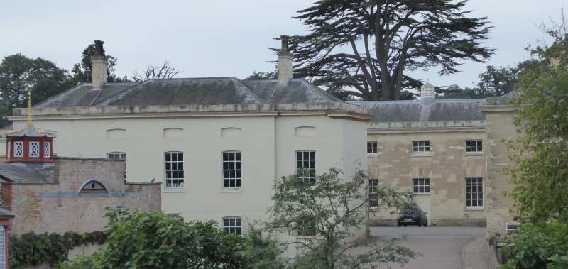
Stableblock, forming a pair with another approximately 75 metres to S. The 2
blocks originally flanked entrance to main E front (now demolished) of Woburn
Abbey. Now converted for commercial use. Circa 1750 by Henry Flitcroft for
John 4th Duke of Bedford. Ashlar, with hipped slate roofs. Originally a 2-
storeyed quadrangular building, but part of NE angle demolished 1949-50,
leaving only a single-storeyed structure to this part. W elevation (towards
house): symmetrical 5-bay facade. Central bay has triangular pediment on
engaged paired Tuscan columns. This frames a round-arched recess. The bay
is surmounted by octagonal drum and dome, with Diocletian windows to all sides
of drum. Outer bays formed by slightly projecting pavilions with Venetian
windows to ground floor and Diocletian windows to first floor. Intervening
bays each have 3 sashes with glazing bars per floor. S elevation symmetrical
5-bay facade. Outer pavilions same as those to W elevation. Central
pedimented bay has paired Tuscan-pilasters flanking a round-headed carriage-
arch. Intervening ranges are of 5 windows each, those to ground floor round-
headed sashes with glazing bars, those to first floor oculi with glazing bars.
Adjoining to NW and SE angles are 2 stretches of ashlar screen wall, possibly
c.1790 additions by Henry Holland. NW stretch originally linked stableblock
to NE angle of house. Raised rectangular panels separated by pilaster
strips. SE wall has rusticated piers at angles.
Listing NGR: SP9664432559
External links are from the relevant listing authority and, where applicable, Wikidata. Wikidata IDs may be related buildings as well as this specific building. If you want to add or update a link, you will need to do so by editing the Wikidata entry.


Other nearby listed buildings