Latitude: 52.9867 / 52°59'12"N
Longitude: -1.4897 / 1°29'22"W
OS Eastings: 434354
OS Northings: 343387
OS Grid: SK343433
Mapcode National: GBR 6D2.N6F
Mapcode Global: WHDGM.26W4
Plus Code: 9C4WXGP6+M4
Entry Name: The Park
Listing Date: 13 February 1967
Grade: II
Source: Historic England
Source ID: 1158248
English Heritage Legacy ID: 78859
ID on this website: 101158248
Location: Amber Valley, Derbyshire, DE56
County: Derbyshire
District: Amber Valley
Civil Parish: Duffield
Built-Up Area: Duffield
Traditional County: Derbyshire
Lieutenancy Area (Ceremonial County): Derbyshire
Church of England Parish: Duffield St Alkmund
Church of England Diocese: Derby
Tagged with: Architectural structure
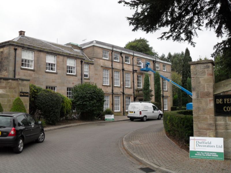
SK 34 43 PARISH OF DUFFIELD TAMWORTH STREET 7/20 (South Side) 13.2.67 The Park II Small country house, now converted into nine flats. Early C18 and late C18 or early C19. Coursed squared gritstone with gritstone dressings. Hipped Welsh slate roof. One stone stack. Two and three storeys. North elevation of four plus seven bays. The seven bay part is of early C18 character. Central Tuscan Doric porch with cornice and open balustrade. Double doors, half glazed, flanked on each side by three closely spaced glazing bar sashes in moulded architraves. Seven similar windows above. Attic storey above with sill band, plain cornice and seven C19 sashes. Doorway to left with moulded surround and a glazing bar sash above in plain surround. Three bays to the left slightly advanced and with glazing bar sashes in plain surrounds, to each floor. Irregular three bay west elevation with an external chimney stack and a two storey canted bay. Interior much altered.
Listing NGR: SK3435443387
External links are from the relevant listing authority and, where applicable, Wikidata. Wikidata IDs may be related buildings as well as this specific building. If you want to add or update a link, you will need to do so by editing the Wikidata entry.


Other nearby listed buildings