Latitude: 51.8709 / 51°52'15"N
Longitude: -0.5844 / 0°35'3"W
OS Eastings: 497556
OS Northings: 220089
OS Grid: SP975200
Mapcode National: GBR F3S.P2N
Mapcode Global: VHFRJ.T7DN
Plus Code: 9C3XVCC8+86
Entry Name: 52
Listing Date: 26 September 1980
Grade: II
Source: Historic England
Source ID: 1158432
English Heritage Legacy ID: 35934
ID on this website: 101158432
Location: Moor End, Central Bedfordshire, LU6
County: Central Bedfordshire
Civil Parish: Eaton Bray
Built-Up Area: Eaton Bray
Traditional County: Bedfordshire
Lieutenancy Area (Ceremonial County): Bedfordshire
Church of England Parish: Eaton Bray with Edlesborough
Church of England Diocese: St.Albans
Tagged with: Building
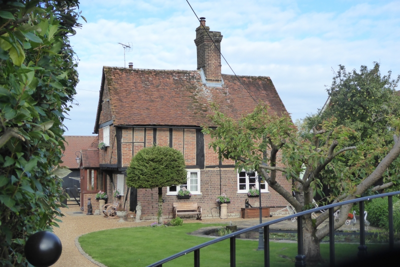
1.
5125 EATON BRAY MOOR END
No 52
SP 9720 35/90
II
2.
C16. Timber-framed with red brick nogging, red brick ground floor. Two storeys.
Old clay tile roof. South gable jettied. Modern casement windows.
Listing NGR: SP9755620089
External links are from the relevant listing authority and, where applicable, Wikidata. Wikidata IDs may be related buildings as well as this specific building. If you want to add or update a link, you will need to do so by editing the Wikidata entry.


Other nearby listed buildings