Approximate Location Map
Large Map »
Latitude: 51.7049 / 51°42'17"N
Longitude: -0.7086 / 0°42'30"W
OS Eastings: 489334
OS Northings: 201474
OS Grid: SP893014
Mapcode National: GBR D4F.1P6
Mapcode Global: VHDVS.NDRW
Plus Code: 9C3XP73R+XH
Entry Name: Wall to South of Townend Farmhouse
Listing Date: 30 July 1984
Grade: II
Source: Historic England
Source ID: 1159151
English Heritage Legacy ID: 44888
ID on this website: 101159151
Location: Great Missenden, Buckinghamshire, HP16
County: Buckinghamshire
Civil Parish: Great Missenden
Built-Up Area: Prestwood
Traditional County: Buckinghamshire
Lieutenancy Area (Ceremonial County): Buckinghamshire
Church of England Parish: Great Missenden with Ballinger and Little Hampden
Church of England Diocese: Oxford
Tagged with: Wall
SP 8901
4/63
GREAT MISSENDEN
HIGH STREET
(west side)
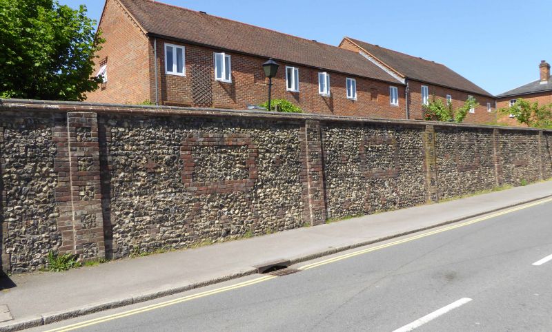
Wall to South of Townend
Farmhouse
GV
II
Early C19. High wall of flint with brick piers and rectangular motif of brick in
each bay, listed for group value.
Listing NGR: SP8933401474
External links are from the relevant listing authority and, where applicable, Wikidata. Wikidata IDs may be related buildings as well as this specific building. If you want to add or update a link, you will need to do so by editing the Wikidata entry.


Other nearby listed buildings
