Latitude: 54.5311 / 54°31'52"N
Longitude: -1.0474 / 1°2'50"W
OS Eastings: 461740
OS Northings: 515512
OS Grid: NZ617155
Mapcode National: GBR PJ41.0H
Mapcode Global: WHF8D.WCDQ
Plus Code: 9C6WGXJ3+F2
Entry Name: Boundary Wall to South West of Numbers 65 to 67
Listing Date: 25 April 1984
Grade: II
Source: Historic England
Source ID: 1159305
English Heritage Legacy ID: 59890
ID on this website: 101159305
Location: Guisborough, Redcar and Cleveland, North Yorkshire, TS14
County: Redcar and Cleveland
Civil Parish: Guisborough
Built-Up Area: Guisborough
Traditional County: Yorkshire
Lieutenancy Area (Ceremonial County): North Yorkshire
Church of England Parish: Guisborough St Nicholas
Church of England Diocese: York
Tagged with: Wall
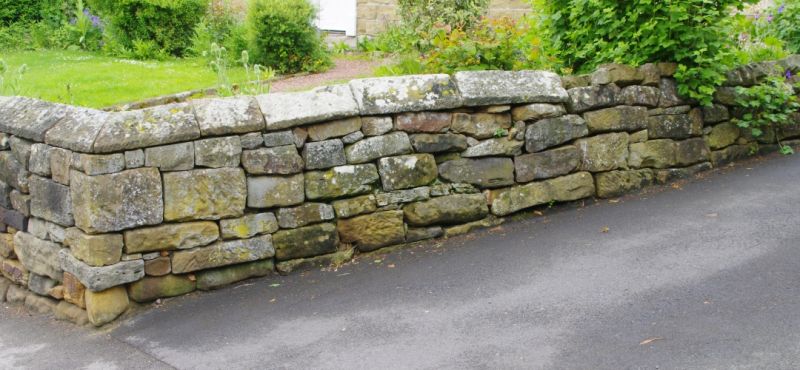
NZ6115 GUISBOROUGH BELMANGATE
(EAST SIDE)
9/21 Boundary wall
to S.W. of Nos
65 and 67
Belmangate.
GV II
Boundary wall to street. Early C19. Squared random rubble sandstone
with sloped copings.
Listing NGR: NZ6174015512
External links are from the relevant listing authority and, where applicable, Wikidata. Wikidata IDs may be related buildings as well as this specific building. If you want to add or update a link, you will need to do so by editing the Wikidata entry.


Other nearby listed buildings