Latitude: 51.555 / 51°33'18"N
Longitude: -0.8418 / 0°50'30"W
OS Eastings: 480396
OS Northings: 184653
OS Grid: SU803846
Mapcode National: GBR C4N.J0C
Mapcode Global: VHDWH.C5BR
Plus Code: 9C3XH545+27
Entry Name: Barn 30 Metres to North West of Lodge Farmhouse
Listing Date: 21 June 1955
Last Amended: 8 January 1987
Grade: II
Source: Historic England
Source ID: 1159765
English Heritage Legacy ID: 47014
ID on this website: 101159765
Location: Medmenham, Buckinghamshire, RG9
County: Buckinghamshire
Civil Parish: Medmenham
Traditional County: Buckinghamshire
Lieutenancy Area (Ceremonial County): Buckinghamshire
Church of England Parish: Medmenham
Church of England Diocese: Oxford
Tagged with: Barn
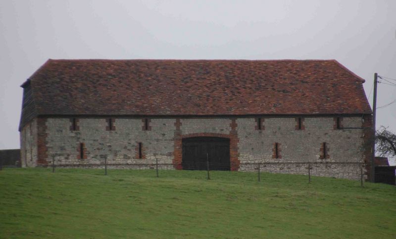
MEDMENHAM HENLEY ROAD SU 88 SW (north side) 8/131 Barn 30m to N.W. of Lodge Farmhouse (formerly listed under Range of Barns to N. of Lodge Farmhouse) 21.6.55 GV II Barn. C17-early C18. Chalk block with narrow brick dressings, flint-faced plinth, weatherboard gables, half-hipped old tile roof. 5 bays. Two rows of vent slits. W. side has double doors with segmental brick arch to centre bay. E. side has lean-to weatherboarded loose boxes flanking gabled cart entry. Double purlin roof with queen struts to low collar and raking queen posts to upper purlins.
Listing NGR: SU8039684653
External links are from the relevant listing authority and, where applicable, Wikidata. Wikidata IDs may be related buildings as well as this specific building. If you want to add or update a link, you will need to do so by editing the Wikidata entry.


Other nearby listed buildings