Latitude: 54.7764 / 54°46'34"N
Longitude: -1.5747 / 1°34'29"W
OS Eastings: 427453
OS Northings: 542467
OS Grid: NZ274424
Mapcode National: GBR KFF6.WL
Mapcode Global: WHC4Q.S6BP
Plus Code: 9C6WQCGG+H4
Entry Name: 10, 11 and 11A, Elvet Bridge
Listing Date: 30 April 1971
Grade: II
Source: Historic England
Source ID: 1159848
English Heritage Legacy ID: 110184
ID on this website: 101159848
Location: The Sands, County Durham, DH1
County: County Durham
Electoral Ward/Division: Elvet and Gilesgate
Parish: City of Durham
Built-Up Area: Durham
Traditional County: Durham
Lieutenancy Area (Ceremonial County): County Durham
Church of England Parish: Durham St Nicholas
Church of England Diocese: Durham
Tagged with: Building
DURHAM AND FRAMWELLGATE ELVET BRIDGE NZ2742SW (North side)
14/132 Nos. 10, 11 and 11A 30.4.71 GV II
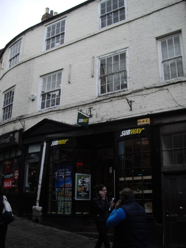
2 houses, now 2 shops. Late C18. Painted English garden wall bond brick (3 and one) with painted ashlar dressings; Welsh slate roof with brick chimneys. Front curved in plan. 3 storeys, 5 bays. Left shop altered. Right shop early C19 with 2 internal steps up to central recessed glazed door; fluted pilasters flank doorway; glazing bars to windows flanking door and to front bow windows. Entablature has modillioned cornice with open pediment over central 2 bays; removed from left 2 bays. 4-panelled house door at right has overlight with glazing bars. Upper floors have 3 wide sashes with glazing bars, some renewed, in 3 central bays; narrower end bays have sash at right on first floor; other windows are blind. All windows have wedge stone lintels and projecting stone sills. Curved roof has 2 ridge chimneys. Interior: each has rear newel stair.
Listing NGR: NZ2745342467
External links are from the relevant listing authority and, where applicable, Wikidata. Wikidata IDs may be related buildings as well as this specific building. If you want to add or update a link, you will need to do so by editing the Wikidata entry.


Other nearby listed buildings