Approximate Location Map
Large Map »
Latitude: 51.8167 / 51°48'59"N
Longitude: -0.8151 / 0°48'54"W
OS Eastings: 481774
OS Northings: 213777
OS Grid: SP817137
Mapcode National: GBR D2X.4Q9
Mapcode Global: VHDV4.TLGQ
Plus Code: 9C3XR58M+MX
Entry Name: 3, Castle Street
Listing Date: 5 February 1973
Grade: II
Source: Historic England
Source ID: 1159953
English Heritage Legacy ID: 41831
ID on this website: 101159953
Location: Aylesbury, Buckinghamshire, HP20
County: Buckinghamshire
Civil Parish: Aylesbury
Built-Up Area: Aylesbury
Traditional County: Buckinghamshire
Lieutenancy Area (Ceremonial County): Buckinghamshire
Church of England Parish: Aylesbury
Church of England Diocese: Oxford
Tagged with: Building
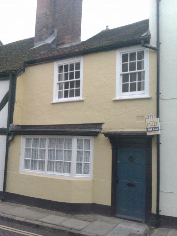
1.
799 CASTLE STREET
(South Side)
No 3
SP 8113 NE 1/11
II GV
2.
C17, altered. Two storeys. Colourwashed brick and plaster. Old tile
roof. Irregular C18 windows, sash type on first floor, and sliding "Yorkshire"
casement on ground floor including bay.
Nos 1 to 15A (odd) form a group.
Listing NGR: SP8177813777
External links are from the relevant listing authority and, where applicable, Wikidata. Wikidata IDs may be related buildings as well as this specific building. If you want to add or update a link, you will need to do so by editing the Wikidata entry.


Other nearby listed buildings
