Latitude: 54.7783 / 54°46'41"N
Longitude: -1.5635 / 1°33'48"W
OS Eastings: 428175
OS Northings: 542687
OS Grid: NZ281426
Mapcode National: GBR KFJ5.9W
Mapcode Global: WHC4Q.Y5N6
Plus Code: 9C6WQCHP+8J
Entry Name: Number 173 and Wall and Outbuilding Attached
Listing Date: 30 April 1971
Grade: II
Source: Historic England
Source ID: 1160000
English Heritage Legacy ID: 110232
ID on this website: 101160000
Location: Gilesgate, County Durham, DH1
County: County Durham
Electoral Ward/Division: Elvet and Gilesgate
Parish: City of Durham
Built-Up Area: Durham
Traditional County: Durham
Lieutenancy Area (Ceremonial County): County Durham
Church of England Parish: Durham St Giles
Church of England Diocese: Durham
Tagged with: Building
DURHAM AND FRAMWELLGATE GILESGATE NZ 2842 NE (South side)
11/180 No. 173 and wall and 30/4/71 outbuilding attached
GV II
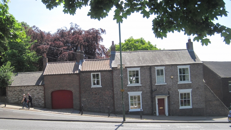
House. Circa 1760. 2 builds. Flemish bond brick with painted ashlar dressings and Welsh slate roof; left extension English garden wall bond brick with renewed pantiled roof. 2-storey, 3-bay main block + 1-bay left section. First build has central 4-panelled door in fluted architrave with bracketed hood. Wedge stone lintels and flat stone sills to ground floor windows, projecting stone sills and smaller wedge stone lintels to those on first floor, all renewed. 2 end brick chimneys. Second build at left has blocked elliptical brick arch with stone impost blocks; window above has header course lintel and projecting stone sill to renewed sashes. Boot scraper recess beside door. Wall attached to left contains C20 iron gate and ends in low buttressed outhouse, with boarded pigeon holes in rear gable.
Listing NGR: NZ2817542687
External links are from the relevant listing authority and, where applicable, Wikidata. Wikidata IDs may be related buildings as well as this specific building. If you want to add or update a link, you will need to do so by editing the Wikidata entry.


Other nearby listed buildings