Latitude: 54.7747 / 54°46'29"N
Longitude: -1.5747 / 1°34'28"W
OS Eastings: 427455
OS Northings: 542284
OS Grid: NZ274422
Mapcode National: GBR KFF7.W5
Mapcode Global: WHC4Q.S7BY
Plus Code: 9C6WQCFG+V4
Entry Name: 46, North Bailey
Listing Date: 6 May 1952
Grade: II
Source: Historic England
Source ID: 1160375
English Heritage Legacy ID: 110329
ID on this website: 101160375
Location: Durham, County Durham, DH1
County: County Durham
Electoral Ward/Division: Elvet and Gilesgate
Parish: City of Durham
Built-Up Area: Durham
Traditional County: Durham
Lieutenancy Area (Ceremonial County): County Durham
Church of England Parish: Durham St Oswald
Church of England Diocese: Durham
Tagged with: Building
DURHAM AND FRAMWELLGATE NORTH BAILEY NZ 2742 SW (West side)
14/277 No. 46 6/5/52 GV II
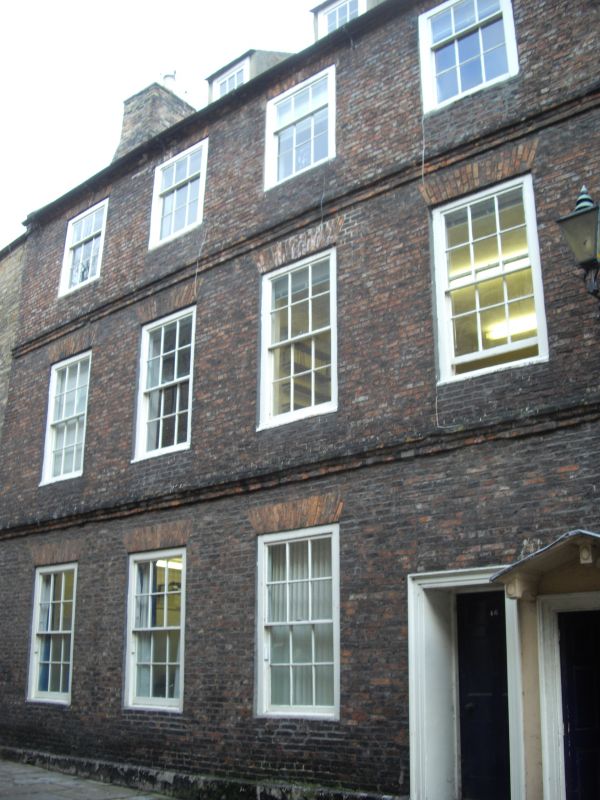
House, now University department. Early C17. English garden wall bond brick of varying numbers of courses; painted ashlar plinth; roof not visible. 3 storeys and attics; 4 windows. Open yard entrance at right in architrave under pointed hood; internal step up to 6-panel door in wood architrave adjacent to yard entrance. Flat brick arches over sashes with glazing bars, those on top floor flush with wall. Deep moulded brick floor strings. Square- headed dormers with rendered cheeks have sashes with glazing bars. Right end brick chimney. Interior: wide open-well stair has low-moulded ramped handrail on 2 turned balusters per tread; shaped tread ends; wide-swept wreath and curtail. 6- and 8-panel doors in deep reveals have lugged architraves.
Listing NGR: NZ2745542284
External links are from the relevant listing authority and, where applicable, Wikidata. Wikidata IDs may be related buildings as well as this specific building. If you want to add or update a link, you will need to do so by editing the Wikidata entry.


Other nearby listed buildings