Latitude: 53.8398 / 53°50'23"N
Longitude: -0.4228 / 0°25'21"W
OS Eastings: 503880
OS Northings: 439329
OS Grid: TA038393
Mapcode National: GBR TSH1.88
Mapcode Global: WHGF4.GRX5
Plus Code: 9C5XRHQG+WV
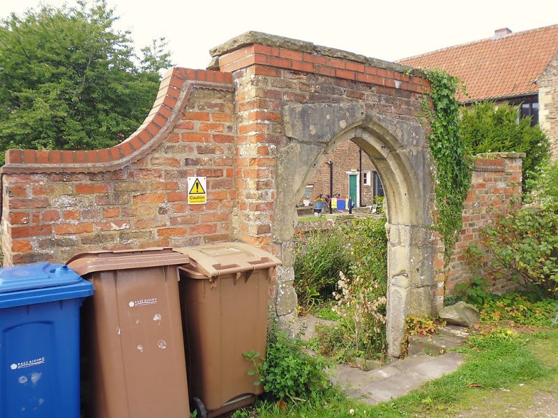
Entry Name: Brick Gateway in Wall to the Old Friary
Listing Date: 1 March 1950
Grade: II
Source: Historic England
Source ID: 1160733
English Heritage Legacy ID: 167165
ID on this website: 101160733
Location: Beverley, East Riding of Yorkshire, HU17
County: East Riding of Yorkshire
Civil Parish: Beverley
Built-Up Area: Beverley
Traditional County: Yorkshire
Lieutenancy Area (Ceremonial County): East Riding of Yorkshire
Church of England Parish: Beverley Minster St John and St Martin
Church of England Diocese: York
Tagged with: Gate
In the entry for BEVERLEY FRIARS LANE TA 0339 (north-west side)
10/45 Brick gateway in wall 1-3-50 to The Old Friary
The previous listing date and the description shall be amended to read:-
TA 0339 BEVERLEY FRIARS LANE (north west side)
10/45 Brick gateway in 2-7-69 wall to The Old Friary -
"National Monument Register Photograph" shall be added as last sentence of the description.
------------------------------------
In the entry for: BEVERLEY FRIARS LANE 10/45 (north-west side)
Brick gateway in wall to The Old Friary Previous listing date "1.3.50" shall be added.
------------------------------------
BEVERLEY FRIARS LANE 10/45 (north west side)
Brick gateway in wall - to The Old Friary GV II Brick gateway of C16 date, similar in type to that in the wall to No 52 Eastgate but formerly surmounted by a curvilinear gable, as was the wall next to it. These features were missing at the time of the survey, but may be replaced when the restoration of the Old Friary is completed.
Listing NGR: TA0388039329
External links are from the relevant listing authority and, where applicable, Wikidata. Wikidata IDs may be related buildings as well as this specific building. If you want to add or update a link, you will need to do so by editing the Wikidata entry.


Other nearby listed buildings