Latitude: 54.5931 / 54°35'35"N
Longitude: -2.0099 / 2°0'35"W
OS Eastings: 399456
OS Northings: 521995
OS Grid: NY994219
Mapcode National: GBR GHDB.N8
Mapcode Global: WHB45.3T56
Plus Code: 9C6VHXVR+72
Entry Name: Field Barn, 20 Metres South of Village Hall
Listing Date: 17 June 1986
Grade: II
Source: Historic England
Source ID: 1160877
English Heritage Legacy ID: 111312
ID on this website: 101160877
Location: Romaldkirk, County Durham, DL12
County: County Durham
Civil Parish: Romaldkirk
Traditional County: Yorkshire
Lieutenancy Area (Ceremonial County): County Durham
Tagged with: Barn
ROMALDKIRK B6277
NY 92 SE (East side, off)
10/140
Field Barn, 20
metres south of
Village Hall
II
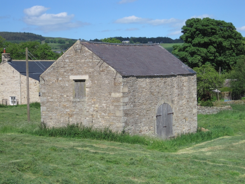
Field barn. Circa 1840. Sandstone rubble; blue slate roof.
One-storey with loft, 3 bays. Flush alternating quoins. South front has pair
of boarded doors in a central elliptical archway with projecting keystone;
flanking single breathers. Returns have paired breathers and a square opening
set high.
A prominent feature in the village.
Listing NGR: NY9945521994
External links are from the relevant listing authority and, where applicable, Wikidata. Wikidata IDs may be related buildings as well as this specific building. If you want to add or update a link, you will need to do so by editing the Wikidata entry.


Other nearby listed buildings