Approximate Location Map
Large Map »
Latitude: 51.8187 / 51°49'7"N
Longitude: -0.8166 / 0°48'59"W
OS Eastings: 481668
OS Northings: 213999
OS Grid: SP816139
Mapcode National: GBR D2Q.Y3H
Mapcode Global: VHDV4.SKP5
Plus Code: 9C3XR59M+F9
Entry Name: 42, Whitehall Street
Listing Date: 5 February 1973
Grade: II
Source: Historic England
Source ID: 1160927
English Heritage Legacy ID: 41972
ID on this website: 101160927
Location: Aylesbury, Buckinghamshire, HP20
County: Buckinghamshire
Civil Parish: Aylesbury
Built-Up Area: Aylesbury
Traditional County: Buckinghamshire
Lieutenancy Area (Ceremonial County): Buckinghamshire
Church of England Parish: Aylesbury
Church of England Diocese: Oxford
Tagged with: Building
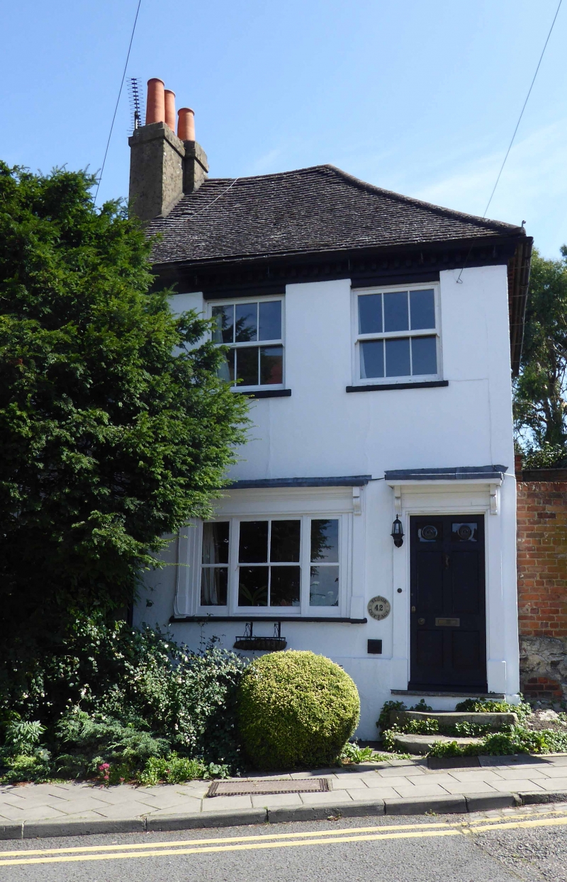
1.
799 WHITEHALL STREET
No 42
SP 8113 NE 1/305
II GV
2.
C18 altered. Stucco, machine tiles. 2 storeys, dentil cornice. 2 Cl9
1st floor sashes, ground floor 3 light C19 sash in surround under cornice
on consoles.
Nos 32 to 42 (even) form a group,
Listing NGR: SP8167013998
External links are from the relevant listing authority and, where applicable, Wikidata. Wikidata IDs may be related buildings as well as this specific building. If you want to add or update a link, you will need to do so by editing the Wikidata entry.


Other nearby listed buildings
