Approximate Location Map
Large Map »
Latitude: 54.5939 / 54°35'37"N
Longitude: -2.008 / 2°0'28"W
OS Eastings: 399580
OS Northings: 522074
OS Grid: NY995220
Mapcode National: GBR GHFB.20
Mapcode Global: WHB45.4S2N
Plus Code: 9C6VHXVR+GQ
Entry Name: Water Pump and Trough, 45 Metres East of Kirk Inn
Listing Date: 17 June 1986
Grade: II
Source: Historic England
Source ID: 1160932
English Heritage Legacy ID: 111321
ID on this website: 101160932
Location: The Green, Romaldkirk, County Durham, DL12
County: County Durham
Civil Parish: Romaldkirk
Traditional County: Yorkshire
Lieutenancy Area (Ceremonial County): County Durham
Tagged with: Well
ROMALDKIRK THE GREEN
NY 9922
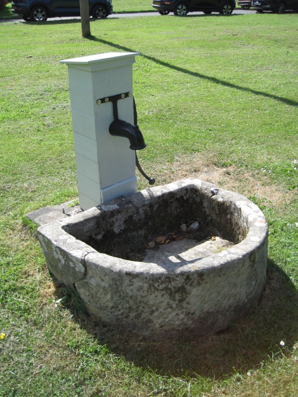
29/149 Water pump and
trough, 45 metres
east of the Kirk Inn
II
Water pump and trough. Mid C19. Iron pump in wood case; stone trough.
Water pump, in planked case with sloping top, has cylindrical front spout and
S-curved side handle.
Low semicircular-plan trough.
A village feature.
Listing NGR: NY9957922073
External links are from the relevant listing authority and, where applicable, Wikidata. Wikidata IDs may be related buildings as well as this specific building. If you want to add or update a link, you will need to do so by editing the Wikidata entry.


Other nearby listed buildings
