Latitude: 54.7719 / 54°46'18"N
Longitude: -1.5756 / 1°34'32"W
OS Eastings: 427401
OS Northings: 541964
OS Grid: NZ274419
Mapcode National: GBR KFF8.P6
Mapcode Global: WHC4Q.RBX5
Plus Code: 9C6WQCCF+PQ
Entry Name: St John's College
Listing Date: 6 May 1952
Grade: II*
Source: Historic England
Source ID: 1161313
English Heritage Legacy ID: 110477
ID on this website: 101161313
Location: Durham, County Durham, DH1
County: County Durham
Electoral Ward/Division: Elvet and Gilesgate
Parish: City of Durham
Built-Up Area: Durham
Traditional County: Durham
Lieutenancy Area (Ceremonial County): County Durham
Church of England Parish: Durham St Oswald
Church of England Diocese: Durham
Tagged with: University building
DURHAM AND FRAMWELLGATE SOUTH BAILEY NZ 2741 NW (East side)
16/420 No. 3 6/5/52 (St. John's College)
GV II*
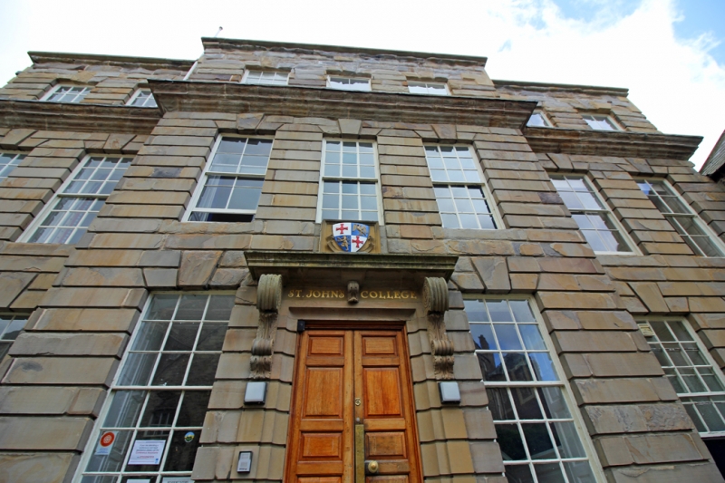
House, now college. Early C18. Sandstone ashlar; roof not visible; brick chimneys. Basement and 3 storeys, 7 bays, the central 3 projecting. 6 steps and terrace to central renewed double door under large hood on carved brackets. Channelled rustication throughout; keyed voussoirs over sash windows with glazing bars. Cyma-moulded coping on basement plinth; prominent second-floor cornice; parapet with roll moulding below flat top. Hipped roof. Spear-headed area railings and plain handrails.
Interior: panelled hall with high-quality open-string stair which has ramped grip handrail on slender Doric balusters with bud plinths, and fluted Corinthian newels; delicately-carved tread ends; one curved flight and wide upper gallery. 6-panelled doors in architraves with deep reveals. Ceiling has dentilled cornice and central leaf rosette with encircling oak leaves. Originally the town house of the Eden family.
Listing NGR: NZ2741841990
External links are from the relevant listing authority and, where applicable, Wikidata. Wikidata IDs may be related buildings as well as this specific building. If you want to add or update a link, you will need to do so by editing the Wikidata entry.


Other nearby listed buildings