Approximate Location Map
Large Map »
Latitude: 54.7705 / 54°46'13"N
Longitude: -1.5776 / 1°34'39"W
OS Eastings: 427272
OS Northings: 541815
OS Grid: NZ272418
Mapcode National: GBR KFF8.7P
Mapcode Global: WHC4Q.QCY6
Plus Code: 9C6WQCCC+6X
Entry Name: Wall Behind Nos. 12 and 12A
Listing Date: 10 March 1988
Grade: I
Source: Historic England
Source ID: 1161398
English Heritage Legacy ID: 110490
ID on this website: 101161398
Location: Neville's Cross, County Durham, DH1
County: County Durham
Electoral Ward/Division: Elvet and Gilesgate
Parish: City of Durham
Built-Up Area: Durham
Traditional County: Durham
Lieutenancy Area (Ceremonial County): County Durham
Church of England Parish: Durham St Oswald
Church of England Diocese: Durham
Tagged with: Wall
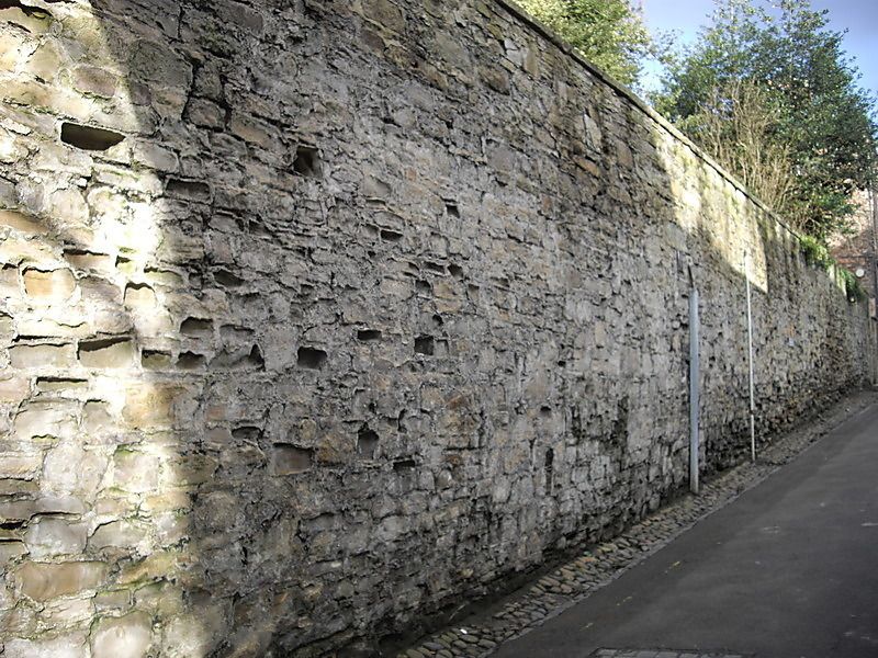
DURHAM AND FRAMWELLGATE SOUTH BAILEY
NZ 2741 NW (South side)
16/433 Wall behind Nos.
12 and 12A
GV I
Castle wall. C12. Coursed squared sandstone. Long stretch of wall curving
northwards to Water Gate, with square turret behind No. 12. 2 chamfered
courses to set-backs. On inner face the gardens are at wall walk level.
Listing NGR: NZ2727241815
External links are from the relevant listing authority and, where applicable, Wikidata. Wikidata IDs may be related buildings as well as this specific building. If you want to add or update a link, you will need to do so by editing the Wikidata entry.


Other nearby listed buildings
