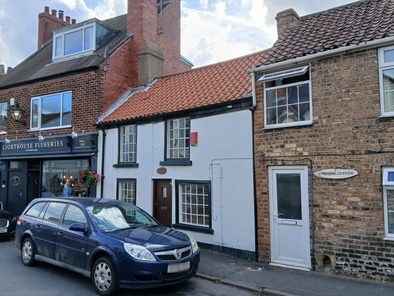
Latitude: 54.1175 / 54°7'2"N
Longitude: -0.1236 / 0°7'25"W
OS Eastings: 522743
OS Northings: 470697
OS Grid: TA227706
Mapcode National: GBR WNLT.1R
Mapcode Global: WHHF2.2RDT
Plus Code: 9C6X4V9G+2H
Entry Name: 6, High Street
Listing Date: 2 January 1985
Grade: II
Source: Historic England
Source ID: 1162251
English Heritage Legacy ID: 166818
ID on this website: 101162251
Location: Flamborough, East Riding of Yorkshire, YO15
County: East Riding of Yorkshire
Civil Parish: Flamborough
Built-Up Area: Flamborough
Traditional County: Yorkshire
Lieutenancy Area (Ceremonial County): East Riding of Yorkshire
Church of England Parish: Flamborough St Oswald
Church of England Diocese: York
Tagged with: Building
TA 27 SW
7/50
FLAMBOROUGH
HIGH STREET
(west side)
No 6
II
Small house late C18 / early C19. Rendered, with stone sills, pantiled
roof, brick stacks. Central direct entry. 2 storeys, 2 windows. C20
door in plain surround. Ground floor has 16-pane and 20-pane bow-
fronted shop windows, upper floor has 16-pane bow windows, all with
wooden architraves and stone sills. Stepped eaves cornice. End stacks.
Listing NGR: TA2274370697
External links are from the relevant listing authority and, where applicable, Wikidata. Wikidata IDs may be related buildings as well as this specific building. If you want to add or update a link, you will need to do so by editing the Wikidata entry.


Other nearby listed buildings