Latitude: 52.3184 / 52°19'6"N
Longitude: -0.0327 / 0°1'57"W
OS Eastings: 534192
OS Northings: 270749
OS Grid: TL341707
Mapcode National: GBR K4D.QJP
Mapcode Global: VHGLZ.DZ3K
Plus Code: 9C4X8X98+9W
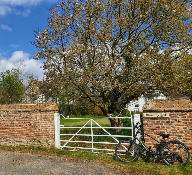
Entry Name: Boundary Wall to Moynes Farmhouse
Listing Date: 4 November 1982
Grade: II
Source: Historic England
Source ID: 1163229
English Heritage Legacy ID: 54033
ID on this website: 101163229
Location: Holywell, Huntingdonshire, Cambridgeshire, PE27
County: Cambridgeshire
District: Huntingdonshire
Town: Huntingdonshire
Civil Parish: Holywell-cum-Needingworth
Built-Up Area: Holywell
Traditional County: Huntingdonshire
Lieutenancy Area (Ceremonial County): Cambridgeshire
Church of England Parish: Holywell St John the Baptist
Church of England Diocese: Ely
Tagged with: Wall
HOLYWELL-CUM-NEEDINGWORTH BACK LANE
1.
5140
(north side)
Holywell
TL 37 SW 7/33 Boundary Wall to
Moynes Hall Farmhouse
II
2.
C17 wall of local red brick with plinth bordering the southern and western boundary of
an original enclosed garden.
Listing NGR: TL3419270749
External links are from the relevant listing authority and, where applicable, Wikidata. Wikidata IDs may be related buildings as well as this specific building. If you want to add or update a link, you will need to do so by editing the Wikidata entry.


Other nearby listed buildings