Approximate Location Map
Large Map »
Latitude: 53.9234 / 53°55'24"N
Longitude: -3.01 / 3°0'36"W
OS Eastings: 333769
OS Northings: 447950
OS Grid: SD337479
Mapcode National: GBR 7RF2.49
Mapcode Global: WH84P.QNV2
Plus Code: 9C5RWXFQ+9X
Entry Name: 32, Lord Street
Listing Date: 31 March 1978
Grade: II
Source: Historic England
Source ID: 1163380
English Heritage Legacy ID: 184755
ID on this website: 101163380
Location: Wyre, Lancashire, FY7
County: Lancashire
District: Wyre
Civil Parish: Fleetwood
Built-Up Area: Fleetwood
Traditional County: Lancashire
Lieutenancy Area (Ceremonial County): Lancashire
Church of England Parish: Fleetwood St Peter and St David
Church of England Diocese: Blackburn
Tagged with: Building
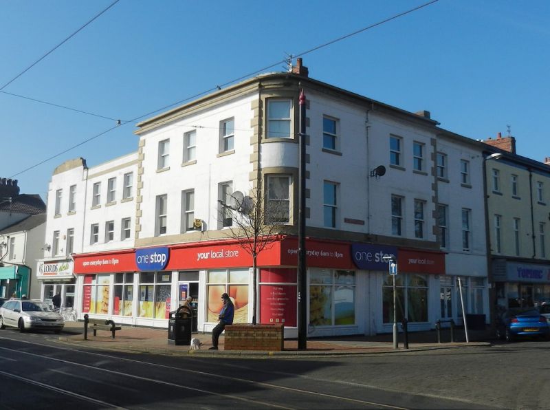
1.
5299 LORD STREET
(North Side)
No 32
SD 3347 3/27
II GV
2.
Mid C19. Stuccoed brick. 3 storeys. Moulded eaves cornice and blocking course.
Rusticated quoins. Rounded corner. 5 ranges of sashes to Saint Peter's Place,
3 to Lord Street, and 1 range on corner. Modern shopfront.
Listing NGR: SD3376947950
External links are from the relevant listing authority and, where applicable, Wikidata. Wikidata IDs may be related buildings as well as this specific building. If you want to add or update a link, you will need to do so by editing the Wikidata entry.


Other nearby listed buildings
