Latitude: 53.4799 / 53°28'47"N
Longitude: -2.1432 / 2°8'35"W
OS Eastings: 390590
OS Northings: 398139
OS Grid: SJ905981
Mapcode National: GBR FXG6.S8
Mapcode Global: WHB9J.1SPM
Plus Code: 9C5VFVH4+XP
Entry Name: Church of St Mary
Listing Date: 17 November 1966
Grade: II
Source: Historic England
Source ID: 1163722
English Heritage Legacy ID: 212717
Also known as: St Mary's Church, Droyslden
ID on this website: 101163722
Location: Droylsden, Tameside, Greater Manchester, M43
County: Tameside
Electoral Ward/Division: Droylsden East
Parish: Non Civil Parish
Built-Up Area: Droylsden
Traditional County: Lancashire
Lieutenancy Area (Ceremonial County): Greater Manchester
Church of England Parish: Droylsden St Mary
Church of England Diocese: Manchester
Tagged with: Church building
DROYLSDEN CHURCH STREET SJ 99 NW
4/61 Church of 17/11/66 St. Mary
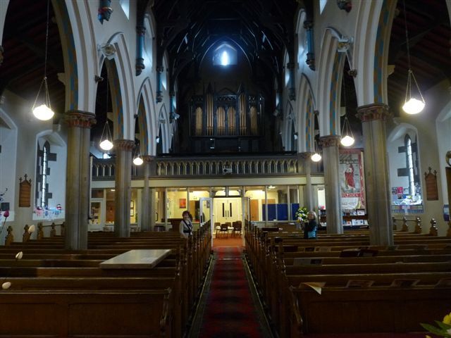
- II Church. 1846-7. By E.H. Shellard for the Church Commissioners. Hammer-dressed stone with slate roof. Nave, clerestory, aisles and chancel. Gothic revival. 6-bay nave and aisles and 3-bay chancel with projecting plinth and continuous hoodmoulds. Each bay has a weathered buttress and paired lancet windows. Spherical triangle clerestory windows. Baptistry projects in bay 2 taking the form of a south porch. Priest's door to chancel. Coped gables with kneelers and a west bellcote. 3-lancet east window. Interior: double-chamfered nave arcade on quatrefoil columns with stiff-leaf capitals. Hammer-beam roof springs from shaft on head stops. West gallery and organ loft which is elaborately painted. Timber and stone fittings include pews and font. Rev. R. Loxham, Illustrations of churches, vol.4, 1846-55,
Listing NGR: SJ9059098139
External links are from the relevant listing authority and, where applicable, Wikidata. Wikidata IDs may be related buildings as well as this specific building. If you want to add or update a link, you will need to do so by editing the Wikidata entry.


Other nearby listed buildings