Latitude: 54.152 / 54°9'7"N
Longitude: -2.7284 / 2°43'42"W
OS Eastings: 352523
OS Northings: 473154
OS Grid: SD525731
Mapcode National: GBR 9NDF.3C
Mapcode Global: WH83P.2W1W
Plus Code: 9C6V572C+RJ
Entry Name: Sanders Farmhouse
Listing Date: 4 October 1967
Grade: II
Source: Historic England
Source ID: 1163881
English Heritage Legacy ID: 181820
ID on this website: 101163881
Location: Borwick, Lancaster, Lancashire, LA6
County: Lancashire
District: Lancaster
Civil Parish: Borwick
Traditional County: Lancashire
Lieutenancy Area (Ceremonial County): Lancashire
Church of England Parish: Warton St Oswald (or Holy Trinity)
Church of England Diocese: Blackburn
Tagged with: Farmhouse
SD 57 SW BORWICK THE GREEN 4/52 4. 10. 1967 Sanders Farmhouse
II
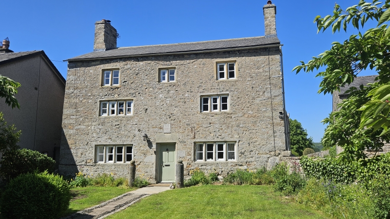
Farmhouse. 'R.S. 1709' on plaque above door. Slobbered rubble with slate roof. 2 unit central-entry plan with gable stacks. 3 storeys. All windows mullioned with rebates and chamfers. On the ground floor are 2 of 4 lights. On the 1st floor there is a 4-light window to the left and a 3-light window to the right. On the 3rd floor are 3 2-light windows. The front door has chamfered jambs and a plain lintel. A massive limestone boulder is built into the right-hand gable wall. Rear wall has chamfered door surround and tall stair window with small panes and plain reveals. A later C18th wing to the rear has a partly blocked plain stone door surround in its south wall. The north wall has a plain stone surround to a fixed window with glazing bars. The west (gable) wall has a flight of external stone steps leading to a doorway on the 1st floor. Interior. Remains of late C18th shouldered stone fireplace in rear wing.
Listing NGR: SD5251373158
External links are from the relevant listing authority and, where applicable, Wikidata. Wikidata IDs may be related buildings as well as this specific building. If you want to add or update a link, you will need to do so by editing the Wikidata entry.


Other nearby listed buildings