Latitude: 53.974 / 53°58'26"N
Longitude: -2.7339 / 2°44'2"W
OS Eastings: 351958
OS Northings: 453356
OS Grid: SD519533
Mapcode National: GBR 9QBH.X5
Mapcode Global: WH84M.ZC9S
Plus Code: 9C5VX7F8+JC
Entry Name: Woodcock Hall
Listing Date: 16 December 1952
Grade: II
Source: Historic England
Source ID: 1164013
English Heritage Legacy ID: 185571
ID on this website: 101164013
Location: Dolphinholme, Wyre, Lancashire, LA2
County: Lancashire
District: Wyre
Civil Parish: Nether Wyresdale
Traditional County: Lancashire
Lieutenancy Area (Ceremonial County): Lancashire
Church of England Parish: Dolphinholme St Mark
Church of England Diocese: Blackburn
Tagged with: House
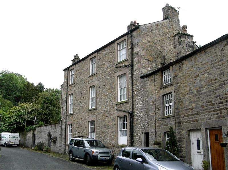
NETHER WYRESDALE WAGON ROAD sn 55 SW 2/177 Lower Dolphinholme 16.12.1952 Woodcock Hall GV II House, c.1800. Sandstone rubble with slate roof, hipped at left. 3 storeys. North-east wall, facing road, of 3 bays which have sashed windows with glazing bars and plain stone surrounds. Chimneys on right-hand gable and to left of right-hand bay. Doorway in left-hand return wall has plain stone surround. Adjoins rear of Old Mill House (q.v.)
Listing NGR: SD5195853356
External links are from the relevant listing authority and, where applicable, Wikidata. Wikidata IDs may be related buildings as well as this specific building. If you want to add or update a link, you will need to do so by editing the Wikidata entry.


Other nearby listed buildings