Latitude: 53.9973 / 53°59'50"N
Longitude: -2.8759 / 2°52'33"W
OS Eastings: 342674
OS Northings: 456053
OS Grid: SD426560
Mapcode National: GBR 8QC6.5T
Mapcode Global: WH84C.SSPG
Plus Code: 9C5VX4WF+WJ
Entry Name: 4, First Terrace
Listing Date: 2 May 1968
Grade: II
Source: Historic England
Source ID: 1164377
English Heritage Legacy ID: 182206
ID on this website: 101164377
Location: Sunderland, Lancaster, Lancashire, LA3
County: Lancashire
District: Lancaster
Civil Parish: Overton
Traditional County: Lancashire
Lieutenancy Area (Ceremonial County): Lancashire
Church of England Parish: Overton St Helen
Church of England Diocese: Blackburn
Tagged with: Building
SD 45 NW OVERTON SUNDERLAND POINT
7/141 First Terrace
2.5.1968 No. 4
GV II
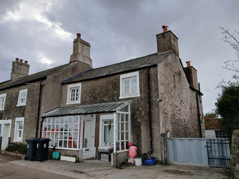
House, probably C19th. Pebbledashed rubble with slate roof. 2 storeys, 2 bays. Windows modern with rendered surrounds. Door, in left-hand bay, has rendered surround. Ground floor mostly covered by glazed porch. Listed for group value only.
Listing NGR: SD4267456053
External links are from the relevant listing authority and, where applicable, Wikidata. Wikidata IDs may be related buildings as well as this specific building. If you want to add or update a link, you will need to do so by editing the Wikidata entry.


Other nearby listed buildings