Latitude: 53.8207 / 53°49'14"N
Longitude: -2.4112 / 2°24'40"W
OS Eastings: 373025
OS Northings: 436125
OS Grid: SD730361
Mapcode National: GBR CSL8.S4
Mapcode Global: WH96P.X7ZB
Plus Code: 9C5VRHCQ+7G
Entry Name: Abbey Presbytery
Listing Date: 13 February 1967
Grade: II
Source: Historic England
Source ID: 1164750
English Heritage Legacy ID: 183557
ID on this website: 101164750
Location: Billington, Ribble Valley, Lancashire, BB7
County: Lancashire
District: Ribble Valley
Civil Parish: Whalley
Built-Up Area: Whalley
Traditional County: Lancashire
Lieutenancy Area (Ceremonial County): Lancashire
Church of England Parish: Whalley St Mary and All Saints
Church of England Diocese: Blackburn
Tagged with: Clergy house
WHALLEY THE SANDS SD 73 NW 2/71 Abbey Presbytery 13-2-1967 GV II
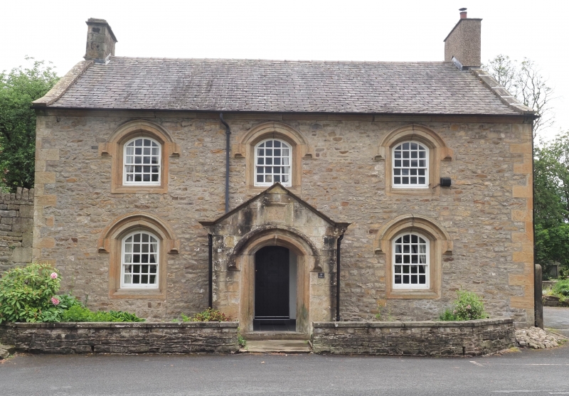
Roman Catholic presbytery, formerly farmhouse, c.1800. Sandstone rubble with slate roof. Double-depth plan. 2 storeys, 3 bays, with cyma-moulded stone cornice. Windows sashed with glazing bars. Stone surrounds double-chamfered with slightly pointed arched heads and hoods. Single-storey gabled porch in middle bay has outer doorway with surround similar to those to windows. Below the apex of the coped gable is a worn blank plaque. Studded inner plank door. Coped gables with chimneys.
Listing NGR: SD7302636126
External links are from the relevant listing authority and, where applicable, Wikidata. Wikidata IDs may be related buildings as well as this specific building. If you want to add or update a link, you will need to do so by editing the Wikidata entry.


Other nearby listed buildings