Latitude: 53.1912 / 53°11'28"N
Longitude: -0.6899 / 0°41'23"W
OS Eastings: 487628
OS Northings: 366808
OS Grid: SK876668
Mapcode National: GBR DLL.SH4
Mapcode Global: WHGJ9.C1PX
Plus Code: 9C5X58R6+F2
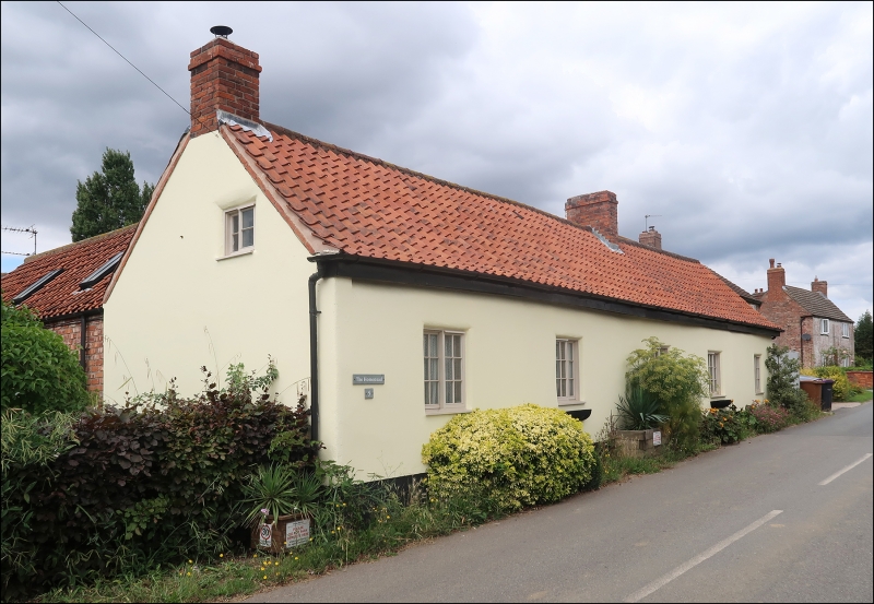
Entry Name: The Homestead
Listing Date: 9 December 1983
Grade: II
Source: Historic England
Source ID: 1165121
English Heritage Legacy ID: 192139
ID on this website: 101165121
Location: Eagle, North Kesteven, Lincolnshire, LN6
County: Lincolnshire
District: North Kesteven
Civil Parish: Eagle and Swinethorpe
Built-Up Area: Eagle
Traditional County: Lincolnshire
Lieutenancy Area (Ceremonial County): Lincolnshire
Church of England Parish: Eagle All Saints
Church of England Diocese: Lincoln
Tagged with: Architectural structure
SK 86 NE EAGLE AND SWINETHORPE HIGH STREET 2/12 (west side) The Homestead II
Cottage. 17C. Timber-framed and rendered. 20C tiled roof with single ridge stack and single gable stack. 5 bay. Single storey plus attic. 5 sliding casements, single attic sliding casements in gables. Chamfered beams inside and evidence of at least one crack.
Listing NGR: SK8762966807
External links are from the relevant listing authority and, where applicable, Wikidata. Wikidata IDs may be related buildings as well as this specific building. If you want to add or update a link, you will need to do so by editing the Wikidata entry.


Other nearby listed buildings