Latitude: 54.4397 / 54°26'22"N
Longitude: -1.7195 / 1°43'10"W
OS Eastings: 418291
OS Northings: 504959
OS Grid: NZ182049
Mapcode National: GBR JKF3.J8
Mapcode Global: WHC66.KNFT
Plus Code: 9C6WC7QJ+V6
Entry Name: 10, High Street
Listing Date: 4 February 1969
Grade: II
Source: Historic England
Source ID: 1166433
English Heritage Legacy ID: 323293
ID on this website: 101166433
Location: Gilling West, North Yorkshire, DL10
County: North Yorkshire
District: Richmondshire
Civil Parish: Gilling with Hartforth and Sedbury
Traditional County: Yorkshire
Lieutenancy Area (Ceremonial County): North Yorkshire
Church of England Parish: Gilling St Agatha
Church of England Diocese: Leeds
Tagged with: Building
NZ 1804-1904
15/79
4.2.69
GILLING WITH HARTFORTH AND SEDBURY
HIGH STREET
(east side)
Gilling West
No 10
GV
II
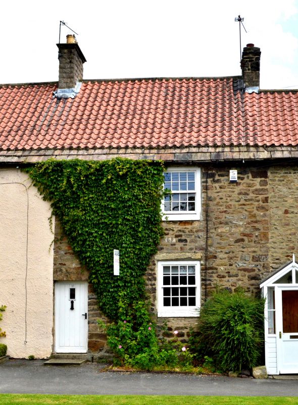
Cottage. Late C18 - early C19. Rubble, C20 pantile roof with stone slates
at eaves. 2 storeys, 1 first-floor window. Quoins to right. To left, 4-
panel door. On each floor a C20 casement window. End stack to right.
Included for group value.
Listing NGR: NZ1829104959
External links are from the relevant listing authority and, where applicable, Wikidata. Wikidata IDs may be related buildings as well as this specific building. If you want to add or update a link, you will need to do so by editing the Wikidata entry.


Other nearby listed buildings