Approximate Location Map
Large Map »
Latitude: 52.4477 / 52°26'51"N
Longitude: -0.1089 / 0°6'32"W
OS Eastings: 528617
OS Northings: 284989
OS Grid: TL286849
Mapcode National: GBR K2R.H8F
Mapcode Global: VHGLC.2Q8Y
Plus Code: 9C4XCVXR+3C
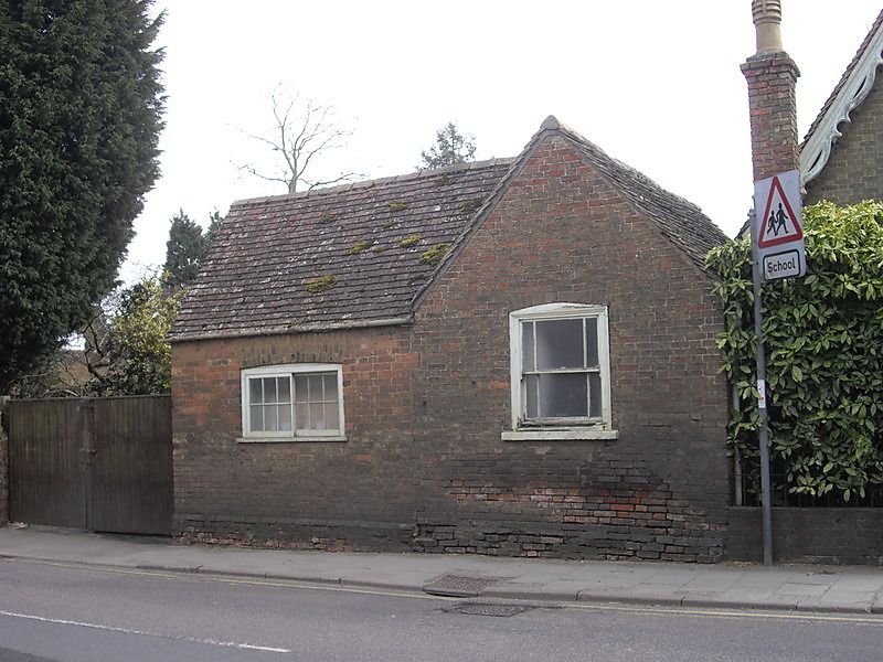
Entry Name: Detached Kitchen to the Gables
Listing Date: 8 June 1983
Grade: II
Source: Historic England
Source ID: 1166557
English Heritage Legacy ID: 54459
ID on this website: 101166557
Location: Ramsey, Huntingdonshire, Cambridgeshire, PE26
County: Cambridgeshire
District: Huntingdonshire
Civil Parish: Ramsey
Built-Up Area: Ramsey
Traditional County: Huntingdonshire
Lieutenancy Area (Ceremonial County): Cambridgeshire
Church of England Parish: Ramsey St Thomas a Becket
Church of England Diocese: Ely
Tagged with: Kitchen
TL 2885-2985 RAMSEY HIGH STREET
(south side)
13/3
Detached kitchen to
The Gables
GV
II
C19 detached kitchen with large backing oven and cooking hearth with boiler.
Single-storey gault brick, plain tile roof. Store and loft to south.
Listing NGR: TL2861784989
External links are from the relevant listing authority and, where applicable, Wikidata. Wikidata IDs may be related buildings as well as this specific building. If you want to add or update a link, you will need to do so by editing the Wikidata entry.


Other nearby listed buildings
