Approximate Location Map
Large Map »
Latitude: 52.3343 / 52°20'3"N
Longitude: -2.0618 / 2°3'42"W
OS Eastings: 395886
OS Northings: 270688
OS Grid: SO958706
Mapcode National: GBR 2FY.MJQ
Mapcode Global: VH9ZL.6LWD
Plus Code: 9C4V8WMQ+P7
Entry Name: 25 and 27, High Street
Listing Date: 8 July 1971
Grade: II
Source: Historic England
Source ID: 1166710
English Heritage Legacy ID: 155694
ID on this website: 101166710
Location: Bromsgrove, Worcestershire, B61
County: Worcestershire
District: Bromsgrove
Electoral Ward/Division: Sanders Park
Parish: Non Civil Parish
Built-Up Area: Bromsgrove
Traditional County: Worcestershire
Lieutenancy Area (Ceremonial County): Worcestershire
Church of England Parish: Bromsgrove
Church of England Diocese: Worcester
Tagged with: Building
HIGH STREET
1.
909 (North West Side)
SO 9570 NE 2/45 Nos 25 & 27
SO 9570 NE 2/44 8.7.71.
II GV
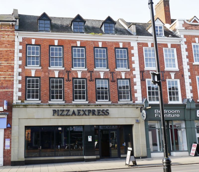
2.
One building, originally two. C18. 3 storeys plus attic. 7 windows. Red
brick facade. Sashes in moulded cased framed with moulded stone key blocks.
Coved stone cornice at eaves. Pedimented dormers (probably modern). Tile
roof. Large modern plate glass shop fronts.
Nos 25 to 35 (odd) form a group.
Listing NGR: SO9588670688
External links are from the relevant listing authority and, where applicable, Wikidata. Wikidata IDs may be related buildings as well as this specific building. If you want to add or update a link, you will need to do so by editing the Wikidata entry.


Other nearby listed buildings
