Latitude: 54.1008 / 54°6'2"N
Longitude: -2.2801 / 2°16'48"W
OS Eastings: 381780
OS Northings: 467249
OS Grid: SD817672
Mapcode National: GBR DPJ0.5Q
Mapcode Global: WH95D.Y6D2
Plus Code: 9C6V4P29+8X
Entry Name: Knight Stainforth Bridge
Listing Date: 13 September 1988
Grade: II
Source: Historic England
Source ID: 1166894
English Heritage Legacy ID: 324364
ID on this website: 101166894
Location: Little Stainforth, North Yorkshire, BD24
County: North Yorkshire
District: Craven
Civil Parish: Stainforth
Traditional County: Yorkshire
Lieutenancy Area (Ceremonial County): North Yorkshire
Church of England Parish: Stainforth St Peter
Church of England Diocese: Leeds
Tagged with: Bridge
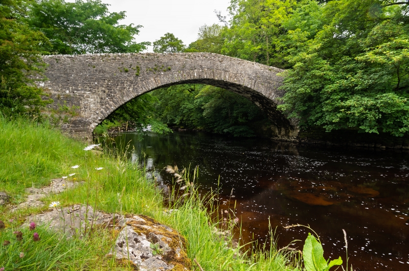
STAINFORTH KNIGHT STAINFORTH
SD 86 NW
2/22 Knight Stainforth
Bridge
II
Narrow bridge. Probably late C17 or C18. Rubble. Single-span segmental arch.
Parapet walls.
Listing NGR: SD8178067249
External links are from the relevant listing authority and, where applicable, Wikidata. Wikidata IDs may be related buildings as well as this specific building. If you want to add or update a link, you will need to do so by editing the Wikidata entry.


Other nearby listed buildings