Latitude: 52.3747 / 52°22'28"N
Longitude: -2.3172 / 2°19'1"W
OS Eastings: 378505
OS Northings: 275228
OS Grid: SO785752
Mapcode National: GBR 0BK.2Z5
Mapcode Global: VH91S.SKCY
Plus Code: 9C4V9MFM+V4
Entry Name: Park House
Listing Date: 22 April 1950
Last Amended: 27 May 1986
Grade: II
Source: Historic England
Source ID: 1167274
English Heritage Legacy ID: 156839
ID on this website: 101167274
Location: Bewdley, Wyre Forest, Worcestershire, DY12
County: Worcestershire
District: Wyre Forest
Civil Parish: Bewdley
Built-Up Area: Bewdley
Traditional County: Worcestershire
Lieutenancy Area (Ceremonial County): Worcestershire
Church of England Parish: Ribbesford with Bewdley and Dowles etc
Church of England Diocese: Worcester
Tagged with: House
SO 7875 SW BEWDLEY CP PAARK LANE (east side) SO 7875 SE 12/191 No 15 (Park House) 13/191 [formerly listed as No 7] 22.4.50
GV II
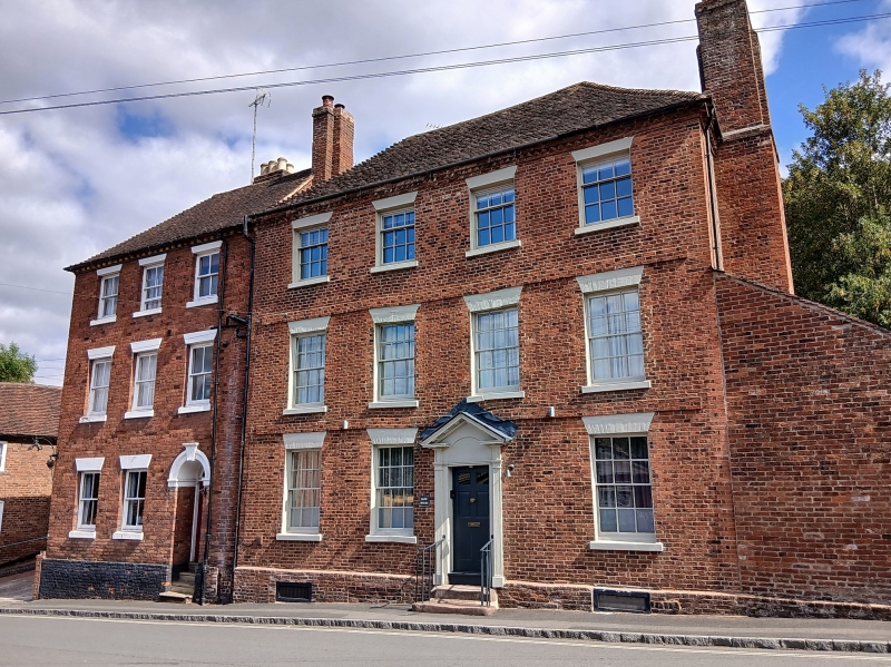
House. Early C18 with early C19 and some late C20 alterations. Brick with hipped tile roof, gable end stacks. Three storeys on cellar, dog tooth brick cornice, bands to ground and first floor; four windows: glazing bar sashes under pointed rubbed brick heads with stone sills; second floor, as below but with 9-pane sashes; ground floor: three windows as on first floor; entrance to right of centre approached by three stone steps with wrought iron railings has a doorcase with fluted pilasters, open pediment, blind fanlight and a 6-panel door, the upper two glazed.
Listing NGR: SO7850575228
External links are from the relevant listing authority and, where applicable, Wikidata. Wikidata IDs may be related buildings as well as this specific building. If you want to add or update a link, you will need to do so by editing the Wikidata entry.


Other nearby listed buildings