Latitude: 53.981 / 53°58'51"N
Longitude: -2.1061 / 2°6'22"W
OS Eastings: 393136
OS Northings: 453882
OS Grid: SD931538
Mapcode National: GBR FQQD.TP
Mapcode Global: WHB76.M68G
Plus Code: 9C5VXVJV+9G
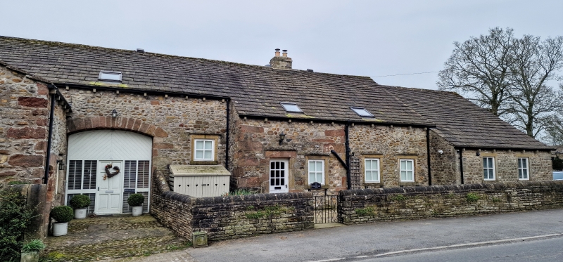
Entry Name: Church Close and attached barn
Listing Date: 10 September 1954
Grade: II
Source: Historic England
Source ID: 1167779
English Heritage Legacy ID: 324943
ID on this website: 101167779
Location: Gargrave, North Yorkshire, BD23
County: North Yorkshire
District: Craven
Civil Parish: Gargrave
Built-Up Area: Gargrave
Traditional County: Yorkshire
Lieutenancy Area (Ceremonial County): North Yorkshire
Church of England Parish: Gargrave St Andrew
Church of England Diocese: Leeds
Tagged with: Architectural structure
This list entry was subject to a Minor Amendment on 23 September 2025 to correct a typo in the description and to reformat the text to current standards
SD 95 SW
5/67
GARGRAVE
CHURCH STREET (west side)
Church Close and attached barn
10.9.54
GV
II
House, late C18, and barn, probably C17 . The house rendered, the barn of slobbered rubble, both with stone slate roofs. House of two storeys and three bays with band between storeys, coped gables and kneelers. Symmetrical arrangement of one three-light recessed square (mullion window to each outer bay on each floor, flanking a door with stone surround and hood surmounted by a single light. All the lights are sashed without glazing bars. Gable chimneys. The barn is long, with a segmental headed cart entry roughly central, and flanked by a catslide on the right and a short wing at right angles on the left which has a chamfered elliptical headed doorway in the return and a round pitch-hole in the gable.
Listing NGR: SD9313653882
External links are from the relevant listing authority and, where applicable, Wikidata. Wikidata IDs may be related buildings as well as this specific building. If you want to add or update a link, you will need to do so by editing the Wikidata entry.


Other nearby listed buildings