Latitude: 53.8003 / 53°48'1"N
Longitude: -1.0434 / 1°2'36"W
OS Eastings: 463104
OS Northings: 434203
OS Grid: SE631342
Mapcode National: GBR PS4H.XF
Mapcode Global: WHFCW.YQBZ
Plus Code: 9C5WRX24+4M
Entry Name: Barlby Hall
Listing Date: 17 November 1966
Grade: II
Source: Historic England
Source ID: 1167806
English Heritage Legacy ID: 326259
ID on this website: 101167806
Location: Barlby, North Yorkshire, YO8
County: North Yorkshire
District: Selby
Civil Parish: Barlby with Osgodby
Built-Up Area: Barlby
Traditional County: Yorkshire
Lieutenancy Area (Ceremonial County): North Yorkshire
Church of England Parish: Barlby All Saints
Church of England Diocese: York
Tagged with: House
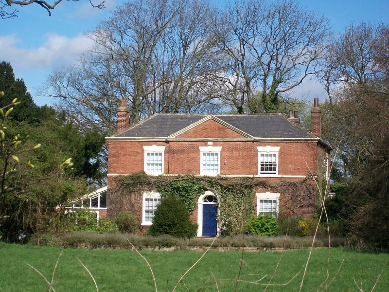
BARLBY YORK ROAD SE 63 SW (north side) 9/3 Barlby Hall 17.11.66 II House. Probably mid C18 with later additions and alterations including early-mid C19 refronting. Pinkish-brown brick with red brick facade in Flemish bond with ashlar dressings and Welsh slate roof. Central hallway plan with range to rear. 2 storeys, 3 bays of which the central bay breaks forward and is pedimented. 2 steps to central 8-fielded panel door beneath decorative fanlight and within reeded architrave with keystone. 16-pane sashes throughout with ashlar sills, wedge lintels and keystones. First floor ashlar band. Moulded cornice and pediment. Hipped roof, side stacks. Interior has C19 open well staircase with wreathed handrail and turned balusters. Mainly 6-fielded-panel doors.
Listing NGR: SE6310434203
External links are from the relevant listing authority and, where applicable, Wikidata. Wikidata IDs may be related buildings as well as this specific building. If you want to add or update a link, you will need to do so by editing the Wikidata entry.


Other nearby listed buildings