Latitude: 50.9647 / 50°57'52"N
Longitude: -1.8363 / 1°50'10"W
OS Eastings: 411594
OS Northings: 118378
OS Grid: SU115183
Mapcode National: GBR 416.JJR
Mapcode Global: FRA 761K.GFN
Plus Code: 9C2WX577+VF
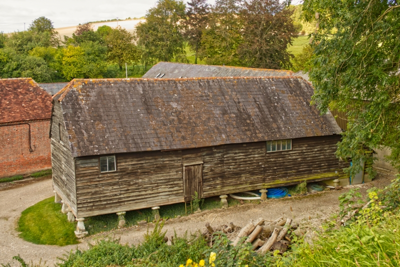
Entry Name: Staddle Granary 60 Metres East North East of Manor House
Listing Date: 13 February 1987
Grade: II
Source: Historic England
Source ID: 1167827
English Heritage Legacy ID: 144134
ID on this website: 101167827
Location: Rockbourne, New Forest, Hampshire, SP6
County: Hampshire
District: New Forest
Civil Parish: Rockbourne
Built-Up Area: Rockbourne
Traditional County: Hampshire
Lieutenancy Area (Ceremonial County): Hampshire
Church of England Parish: Rockbourne St Andrew
Church of England Diocese: Salisbury
Tagged with: Granary
ROCKBOUNNE MANOR FARM SU 1118 14/32 Staddle Granary 60m ENE of Manor House GV II
Staddle barn. Late C18. Timber-frame weatherboarded, slate roof, tile ridges. 5 bay staddle barn with projecting midstrey porch, barn on 18 staddle stones. Front has porch on 4 staddle stones infront of RH of centre bay. Roof of porch hipped, main roof half-hipped.
Listing NGR: SU1163218400
External links are from the relevant listing authority and, where applicable, Wikidata. Wikidata IDs may be related buildings as well as this specific building. If you want to add or update a link, you will need to do so by editing the Wikidata entry.


Other nearby listed buildings