Latitude: 53.9835 / 53°59'0"N
Longitude: -2.1024 / 2°6'8"W
OS Eastings: 393384
OS Northings: 454169
OS Grid: SD933541
Mapcode National: GBR FQRC.MR
Mapcode Global: WHB76.P42H
Plus Code: 9C5VXVMX+C3
Entry Name: Ivy House Farm
Listing Date: 31 May 1989
Grade: II
Source: Historic England
Source ID: 1167839
English Heritage Legacy ID: 324966
ID on this website: 101167839
Location: Gargrave, North Yorkshire, BD23
County: North Yorkshire
District: Craven
Civil Parish: Gargrave
Built-Up Area: Gargrave
Traditional County: Yorkshire
Lieutenancy Area (Ceremonial County): North Yorkshire
Church of England Parish: Gargrave St Andrew
Church of England Diocese: Leeds
Tagged with: Agricultural structure
SD 9354
6/91
GARGRAVE
SOUTH STREET
No 6 (Ivy House Farm)
GV
II
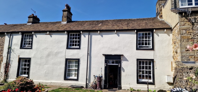
House, early C19. Rendered, stone slate roof. Two storeys and three bays.
Large sash windows with all glazing bars. Between the second and third bays a
pilaster doorcase of simple type, 6-panelled door and overlight with glazing
bars. Two moulded chimneys.
Listing NGR: SD9338454169
External links are from the relevant listing authority and, where applicable, Wikidata. Wikidata IDs may be related buildings as well as this specific building. If you want to add or update a link, you will need to do so by editing the Wikidata entry.


Other nearby listed buildings