Latitude: 51.3377 / 51°20'15"N
Longitude: -1.1437 / 1°8'37"W
OS Eastings: 459746
OS Northings: 160193
OS Grid: SU597601
Mapcode National: GBR 949.5N4
Mapcode Global: VHCZV.4M7W
Plus Code: 9C3W8VQ4+3G
Entry Name: Hatch Cottage
Listing Date: 18 May 1984
Grade: II
Source: Historic England
Source ID: 1167932
English Heritage Legacy ID: 138299
ID on this website: 101167932
Location: Tadley Hill, Basingstoke and Deane, Hampshire, RG26
County: Hampshire
District: Basingstoke and Deane
Civil Parish: Tadley
Traditional County: Hampshire
Lieutenancy Area (Ceremonial County): Hampshire
Church of England Parish: Tadley St Peter
Church of England Diocese: Winchester
Tagged with: Cottage Thatched cottage
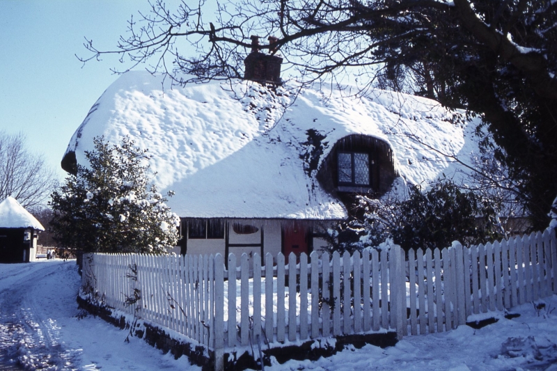
SU 56 SE TADLEY CHURCH ROAD
4/28
Hatch Cottage
II
C16, C18 and C20. Cruck-built timber-framed house of one-storey and attic. Thatched
roof, one eyebrow dormer. Exposed frame, with cruck on the north gable, with painted
brick infill. Casements. Modern door.
Listing NGR: SU5950461038
External links are from the relevant listing authority and, where applicable, Wikidata. Wikidata IDs may be related buildings as well as this specific building. If you want to add or update a link, you will need to do so by editing the Wikidata entry.


Other nearby listed buildings