Latitude: 50.9177 / 50°55'3"N
Longitude: -3.4205 / 3°25'13"W
OS Eastings: 300239
OS Northings: 114099
OS Grid: ST002140
Mapcode National: GBR LL.QK88
Mapcode Global: FRA 36QP.37J
Plus Code: 9C2RWH9H+3Q
Entry Name: Sellake Farmhouse
Listing Date: 5 April 1966
Grade: II*
Source: Historic England
Source ID: 1168935
English Heritage Legacy ID: 95361
ID on this website: 101168935
Location: Mid Devon, EX16
County: Devon
District: Mid Devon
Civil Parish: Halberton
Traditional County: Devon
Lieutenancy Area (Ceremonial County): Devon
Church of England Parish: Halberton
Church of England Diocese: Exeter
Tagged with: Farmhouse Thatched farmhouse
HALBERTON ST 01 SW 2/174 - Sellake Farmhouse 5.4.66 - II*
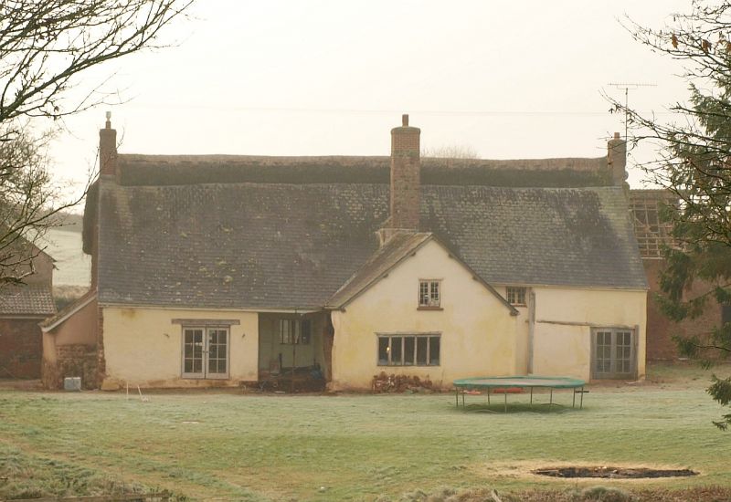
Farmhouse. Circa 1600. Cob, stone plinth, plastered under gabled-end thatched roof. 3-room, through-passage plan with rear outshut under slated catslide roof. Higher end to left of passage; external left-hand end stack heats inner room; rear (formerly external) lateral stack heats hall; internal right-hand end stack with bake-oven bulge heats service end; all stacks with brick shafts, the lateral stack substantially of stone. 2-storeys. Front: 5-window range; all casement windows; first floor windows (except that to lower end) barred, C19, and under very shallow eyebrow eaves; 8-panes per light; inner room chamber of 5-lights, the others of 3. Ground floor with three 4-light barred casement windows; French windows to inner room; C19 panelled door to passage; another door to lower end (kitchen). Two 2-light windows to right hand end elevation, one C20 metal framed window to left; 2 and 5-light window to rear. Interior: deeply chamfered cross beam to lower end room; the fireplace lintel recently (February 1985) removed in part as a result of fire damage, is quite exceptionally large. Stud and panel screen (chamfered and with carpenter's mitres) to lower end of passage; hall with composite double ovolo and double cavetto intersecting beams forming a grid of 4 ceiling squares; inner room with intersecting beams that carry an unusual moulding of 2 rolls flanking a run of raised saltires or dogtooth ornaments; and forming a grid of 4 ceiling squares. Roof: 4 jointed crucks, apex morticed and pegged, diagonal ridge-piece; straight collars pegged and morticed; 2 pairs of trenched purlins. All are clean, although the left hand end truss has been charred by fire.
Listing NGR: ST0023914099
External links are from the relevant listing authority and, where applicable, Wikidata. Wikidata IDs may be related buildings as well as this specific building. If you want to add or update a link, you will need to do so by editing the Wikidata entry.


Other nearby listed buildings