Latitude: 52.6488 / 52°38'55"N
Longitude: -0.4772 / 0°28'37"W
OS Eastings: 503121
OS Northings: 306757
OS Grid: TF031067
Mapcode National: GBR FVS.S79
Mapcode Global: WHGLX.MPZ8
Plus Code: 9C4XJGXF+G4
Entry Name: 21, St Martin's
Listing Date: 22 May 1954
Grade: II
Source: Historic England
Source ID: 1169113
English Heritage Legacy ID: 193675
ID on this website: 101169113
Location: Newtown, South Kesteven, Lincolnshire, PE9
County: Lincolnshire
District: South Kesteven
Civil Parish: Stamford
Built-Up Area: Stamford
Traditional County: Northamptonshire
Lieutenancy Area (Ceremonial County): Lincolnshire
Tagged with: Building
1.
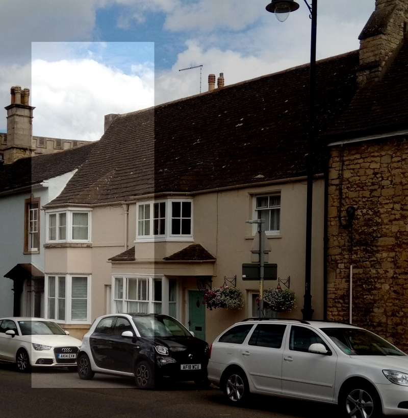
1671 ST MARTIN'S
(East Side)
No 21
TF 0506 1/204 22.5.54.
II GV
2.
Same build as No 22 (q.v.). Early Cl7. 2 storeys, stccoed. Canted bay contains
4-light windows with C19 casements, Stone bands. Small plinth. Stone under string
at base of bay. C19 door in plain surround with keystone. Iron foot scraper.
Nos 18 to 38 (consec) and the Church of St Martin form a group.
Listing NGR: TF0312106757
External links are from the relevant listing authority and, where applicable, Wikidata. Wikidata IDs may be related buildings as well as this specific building. If you want to add or update a link, you will need to do so by editing the Wikidata entry.


Other nearby listed buildings