Latitude: 52.5346 / 52°32'4"N
Longitude: 1.1639 / 1°9'49"E
OS Eastings: 614679
OS Northings: 297680
OS Grid: TM146976
Mapcode National: GBR VHF.12M
Mapcode Global: VHL8H.4K49
Plus Code: 9F43G5M7+VH
Entry Name: Church of All Saints
Listing Date: 7 December 1959
Grade: I
Source: Historic England
Source ID: 1170251
English Heritage Legacy ID: 224958
Also known as: All Saints, Ashwellthorpe
ID on this website: 101170251
Location: All Saints' Church, South Norfolk, NR16
County: Norfolk
District: South Norfolk
Civil Parish: Ashwellthorpe and Fundenhall
Built-Up Area: Ashwellthorpe
Traditional County: Norfolk
Lieutenancy Area (Ceremonial County): Norfolk
Tagged with: Church building
1. 5321 ASHWELLTHORPE THE STREET (north side) Ashwellthorpe Church of All Saints TM 19 NW 2/1 7.12.59
I
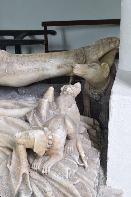
2. C13, C14 and C15. Late C13 west tower with diagonal buttresses, later embattled parapet of brick and flint chequerwork, C13 2-light west window and 2-light bell-openings with Y tracery. Early C14 chancel with 3-light east window with ogee arch. Very tall nave with large Perpendicular north and south windows. C15 south porch with niches flanking entrance and segmental brick gable of circa 1700. North chapel probably C15. Flint rubble and stone dressings, partly rendered, and with slate roofs. Very fine alabaster tomb 1417 to Sir Edmund de Thorpe with effigies. Octagonal font of 1660. Traceried base of screen. Churchyard: C18 and early C19 headstones mostly south of church.
Listing NGR: TM1467997680
External links are from the relevant listing authority and, where applicable, Wikidata. Wikidata IDs may be related buildings as well as this specific building. If you want to add or update a link, you will need to do so by editing the Wikidata entry.


Other nearby listed buildings