Latitude: 54.3003 / 54°18'1"N
Longitude: -0.9172 / 0°55'1"W
OS Eastings: 470562
OS Northings: 489950
OS Grid: SE705899
Mapcode National: GBR QL1Q.77
Mapcode Global: WHF9M.W5DN
Plus Code: 9C6X832M+44
Entry Name: Prospect Farmhouse
Listing Date: 24 June 1987
Last Amended: 4 September 1987
Grade: II
Source: Historic England
Source ID: 1173154
English Heritage Legacy ID: 328923
ID on this website: 101173154
Location: Hutton-le-Hole, North Yorkshire, YO62
County: North Yorkshire
District: Ryedale
Civil Parish: Hutton-le-Hole
Traditional County: Yorkshire
Lieutenancy Area (Ceremonial County): North Yorkshire
Church of England Parish: Lastingham St Mary
Church of England Diocese: York
Tagged with: Farmhouse
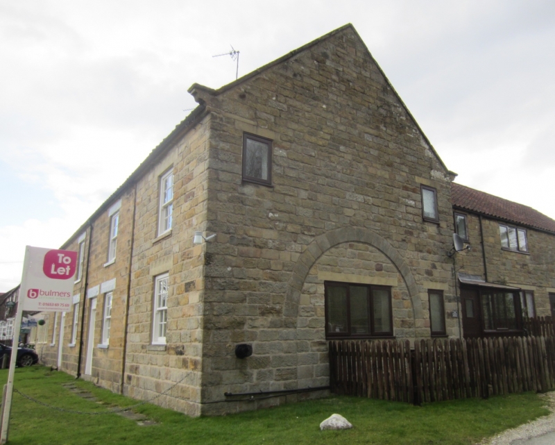
HUTTON-LE-HOLE THE VILLAGE SE 7090 SE 7089 (east side) 11/87 Prospect Farmhouse and attached cottage GV II Farmhouse, attached cottage and farmbuildings; now house and attached cottage. 1823 on reset datestone from cart arch. Farmbuildings altered, part-demolished and rebuilt in 1986. Herringbone-tooled sandstone with rebuilding in reused sandstone; pantile roof with one stone and one brick stack. Central-entry plan house, with direct-entry plan cottage later extended into raised and rebuilt farmbuilding to right. 2-storey, 3-window with 2-storey, single-window extension to right. Doors of 6 raised and fielded panels to centre and centre left. 12-pane sashes with painted stone sills throughout; painted herringbone-tooled lintels to all openings. Coped gables and shaped kneelers. Left and right of centre stacks. Right gable wall: contains rebuilt cart arch formerly sited on the street. Arch is semicircular of voussoirs with dated keystone.
--------------------------------------------------
HUTTON-LE-HOLE THE VILLAGE SE 7090 (east side) SE 7089 11/87 Prospect Farmhouse GV II Farmhouse.Early C19.Herringbone-tooled sandstone;pantile roof with one stone and one brick stack.Central-entry plan house.2-storey,3-window front.Doors of 6 raised and fielded panels to centre and centre left.12-pane sashes with painted stone sills through out;painted herringbone-tooled lintels to all openings.Coped gables and shaped kneelers.Left and right of centre stacks.
Listing NGR: SE7056289950
External links are from the relevant listing authority and, where applicable, Wikidata. Wikidata IDs may be related buildings as well as this specific building. If you want to add or update a link, you will need to do so by editing the Wikidata entry.


Other nearby listed buildings