Latitude: 54.1661 / 54°9'57"N
Longitude: -0.9319 / 0°55'55"W
OS Eastings: 469829
OS Northings: 474999
OS Grid: SE698749
Mapcode National: GBR PNY8.1B
Mapcode Global: WHFB6.NKF2
Plus Code: 9C6X5389+C6
Entry Name: House Immediately to the North of Cooperative Stores
Listing Date: 22 June 1987
Grade: II
Source: Historic England
Source ID: 1173342
English Heritage Legacy ID: 329123
ID on this website: 101173342
Location: Slingsby, North Yorkshire, YO62
County: North Yorkshire
District: Ryedale
Civil Parish: Slingsby
Built-Up Area: Slingsby
Traditional County: Yorkshire
Lieutenancy Area (Ceremonial County): North Yorkshire
Church of England Parish: Slingsby All Saints
Church of England Diocese: York
Tagged with: House
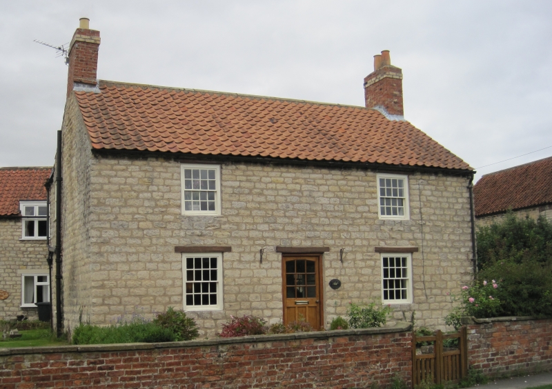
SLINGSBY RAILWAY STREET SE 6975 SE 6974 (east side) 9/166 House immediately to the 10/166 north of Co-operative Stores GV II House. Late C18. Hammer-dressed limestone with pantile roof. Central- entry plan with outshut and cross wing to rear. 2 storeys, 2 first-floor windows. Late C20 part-glazed door. 16-pane sashes with timber lintels throughout. End stacks.
Listing NGR: SE6982974999
External links are from the relevant listing authority and, where applicable, Wikidata. Wikidata IDs may be related buildings as well as this specific building. If you want to add or update a link, you will need to do so by editing the Wikidata entry.


Other nearby listed buildings