Approximate Location Map
Large Map »
Latitude: 51.1834 / 51°11'0"N
Longitude: -3.4441 / 3°26'38"W
OS Eastings: 299161
OS Northings: 143681
OS Grid: SS991436
Mapcode National: GBR LK.5R9J
Mapcode Global: VH6GM.8J24
Plus Code: 9C3R5HM4+98
Entry Name: The Cage
Listing Date: 6 November 1975
Last Amended: 4 August 1983
Grade: II
Source: Historic England
Source ID: 1173386
English Heritage Legacy ID: 264682
ID on this website: 101173386
Location: Dunster, Somerset, TA24
County: Somerset
District: Somerset West and Taunton
Civil Parish: Dunster
Built-Up Area: Dunster
Traditional County: Somerset
Lieutenancy Area (Ceremonial County): Somerset
Tagged with: Architectural structure
1.
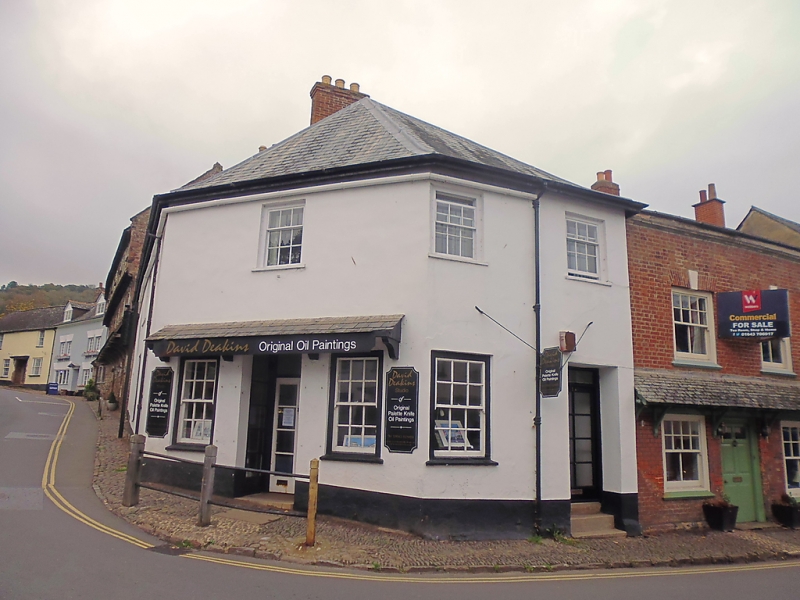
5366 DUNSTER HIGH STREET
(West Side)
No 1 (The Cage)
SS 9843-9943 4/50 6.11.75
II GV
2.
Includes No 2 Church Street. Early 19th century. Render, hipped slate roof. Two
storeys. Two windows to High Street, sashes with glazing bars, right-hand recessed
square head door. Angled corner front with two sash windows and central doorway under
slated pent. Four window return to Church Street with plain left-hand door.
Listing NGR: SS9915043681
External links are from the relevant listing authority and, where applicable, Wikidata. Wikidata IDs may be related buildings as well as this specific building. If you want to add or update a link, you will need to do so by editing the Wikidata entry.


Other nearby listed buildings
