Latitude: 54.447 / 54°26'49"N
Longitude: -0.7554 / 0°45'19"W
OS Eastings: 480802
OS Northings: 506448
OS Grid: NZ808064
Mapcode National: GBR RK50.7M
Mapcode Global: WHF8Y.CHH6
Plus Code: 9C6XC6WV+RR
Entry Name: 4, EGTON VILLAGE (See details for further address information)
Listing Date: 6 October 1969
Grade: II
Source: Historic England
Source ID: 1173568
English Heritage Legacy ID: 327498
ID on this website: 101173568
Location: Egton, North Yorkshire, YO21
County: North Yorkshire
District: Scarborough
Civil Parish: Egton
Traditional County: Yorkshire
Lieutenancy Area (Ceremonial County): North Yorkshire
Church of England Parish: Egton St Hilda
Church of England Diocese: York
Tagged with: Building
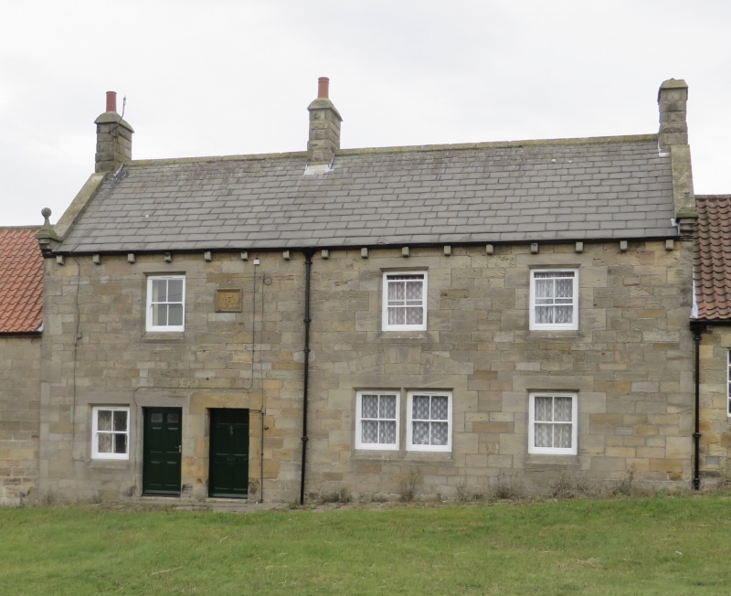
EGTON EGTON VILLAGE NZ8006-8106 (west side) 15/28 No.4 High Street 6.10.69 GV II House. Dated 1880, incorporating remains of C17 house. Re-used sandstone, some tooled, hammered and squared; stone slate roof with stone dressings. 2-storey, 3-window irregular front. Paired left-of-centre doors with glazed panels. Chamfered and quoined right-hand doorway, with lintel dated 1686, survives from earlier house. All windows 4-pane sashes, paired at right of centre, beneath relieving arch. All openings quoined and chamfered in imitation of dated doorway. Recessed date panel in moulded surround on first floor records rebuilding of 1880 for the Foster (Egton) Estate. Corbelled eaves. Coped gables and moulded kneelers supporting ball and pedestal finials. End and left-of-centre stacks.
Listing NGR: NZ8080206448
External links are from the relevant listing authority and, where applicable, Wikidata. Wikidata IDs may be related buildings as well as this specific building. If you want to add or update a link, you will need to do so by editing the Wikidata entry.


Other nearby listed buildings