Latitude: 51.7531 / 51°45'11"N
Longitude: -0.3373 / 0°20'14"W
OS Eastings: 514870
OS Northings: 207357
OS Grid: TL148073
Mapcode National: GBR H89.5JP
Mapcode Global: VHGPQ.36KC
Plus Code: 9C3XQM37+73
Entry Name: The Grange
Listing Date: 8 May 1950
Grade: II*
Source: Historic England
Source ID: 1174089
English Heritage Legacy ID: 163428
ID on this website: 101174089
Location: St Albans, St. Albans, Hertfordshire, AL1
County: Hertfordshire
District: St. Albans
Electoral Ward/Division: St Peters
Parish: Non Civil Parish
Built-Up Area: St Albans
Traditional County: Hertfordshire
Lieutenancy Area (Ceremonial County): Hertfordshire
Church of England Parish: St Albans St Peter
Church of England Diocese: St.Albans
Tagged with: Building
ST PETER'S STREET *. (East Side) 1582 No 16 (The Grange) TL 1407 SE 9/62 8.5.50
II*
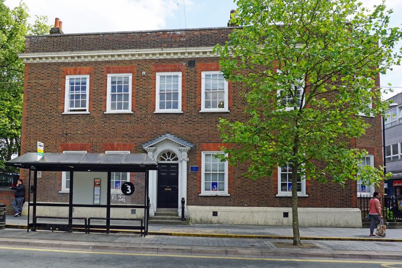
2. Later Cl8. 2 storeys, 5 windows on street front, 7 windows on south return. Brown brick with red brick dressings. Wood, modillion cornice below brick parapet. 2 canted bays on south front, each with 3 windows. Venetian window between bays on 1st floor. Gauged, flat, brick arches to renewed sash windows with glazing bars in near-flush frames. Doorcase, in centre of street front, has attached, Ionic columns supporting entablature with modillions and dentils to cornice; and open pediment with similar cornice over. Panelled reveals to door with dentil cornice head and decorative fanlight. Inside a staircase with slender, turned balusters, 3 to a tread, and cut string; 3 carved fireplaces, 2 of wood and one of marble; carved enrichment to windows and shutters and to doors of 6 fielded panels; and several rooms with plaster work in Adam style.
Listing NGR: TL1487007357
External links are from the relevant listing authority and, where applicable, Wikidata. Wikidata IDs may be related buildings as well as this specific building. If you want to add or update a link, you will need to do so by editing the Wikidata entry.


Other nearby listed buildings