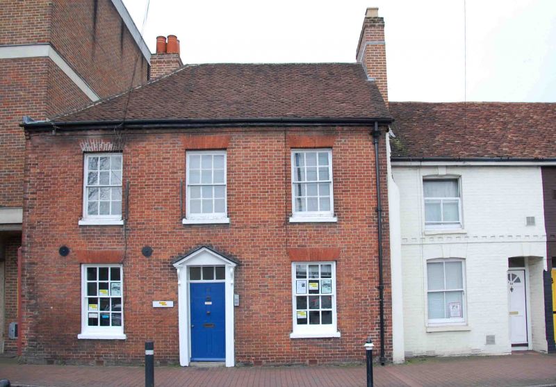
Latitude: 51.0639 / 51°3'49"N
Longitude: -1.3127 / 1°18'45"W
OS Eastings: 448255
OS Northings: 129618
OS Grid: SU482296
Mapcode National: GBR 861.BWM
Mapcode Global: FRA 8649.NDP
Plus Code: 9C3W3M7P+HW
Entry Name: 57, Upper Brook Street
Listing Date: 14 January 1974
Grade: II
Source: Historic England
Source ID: 1174127
English Heritage Legacy ID: 144874
ID on this website: 101174127
Location: Winchester, Hampshire, SO23
County: Hampshire
District: Winchester
Electoral Ward/Division: St Michael
Parish: Non Civil Parish
Built-Up Area: Winchester
Traditional County: Hampshire
Lieutenancy Area (Ceremonial County): Hampshire
Church of England Parish: Winchester Holy Trinity
Church of England Diocese: Winchester
Tagged with: Building
UPPER BROOK STREET 1. 1833 No 57 SU 4829 NW 3/445 II 2. Late Cl8/Early C19. Red brick. Two storeys, three windows, sashes with glazing bars. Central six-panel door with panelled reveals, open pediment and rectangular fan. Cornice, old tile roof.
Listing NGR: SU4825429617
External links are from the relevant listing authority and, where applicable, Wikidata. Wikidata IDs may be related buildings as well as this specific building. If you want to add or update a link, you will need to do so by editing the Wikidata entry.


Other nearby listed buildings