Latitude: 51.6445 / 51°38'40"N
Longitude: -0.2982 / 0°17'53"W
OS Eastings: 517848
OS Northings: 195333
OS Grid: TQ178953
Mapcode National: GBR 7N.1HJ
Mapcode Global: VHGQ3.SX6R
Plus Code: 9C3XJPV2+QP
Entry Name: Almshouse Almshouses
Listing Date: 30 April 1974
Last Amended: 12 August 1985
Grade: II
Source: Historic England
Source ID: 1174131
English Heritage Legacy ID: 164210
ID on this website: 101174131
Location: Elstree, Hertsmere, Hertfordshire, WD6
County: Hertfordshire
District: Hertsmere
Civil Parish: Elstree and Borehamwood
Built-Up Area: Elstree
Traditional County: Hertfordshire
Lieutenancy Area (Ceremonial County): Hertfordshire
Church of England Parish: Elstree and Borehamwood
Church of England Diocese: St.Albans
Tagged with: Almshouse
TQ 1795 ELSTREE HIGH STREET (East side) Elstree
14/159 Nos. I and 2 Almshouses 30.4.74 (formerly listed as The Almshouses)
GV II
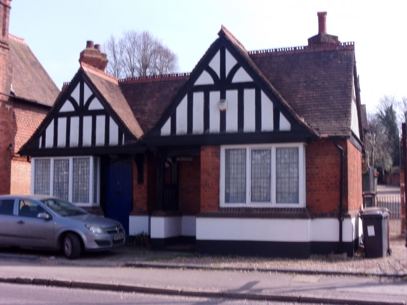
Group of 3 almshouses. c.1882-3, erected for Lord Aldenham. Brick, sham timber framing, tile hanging. Tiled roof. Asymmetrical Arts and Crafts Style. One storey. Nos. 1 and 2 have entrances to High Street towards centre under separate gables. No. 2 projects forward with entrance in side of timber recess. 4 centred heads to porch and to door to No. 1. No. 1 has a 3 light bay window to left, leaded lights, chamfered brick base. Similar window to right on No. 2. Moulded arched braces support slightly projecting rendered gables without original sham timber framing. Ridge of wing to right is higher. Ridge tiles. Rendered plinth. Right return has 2 gables, that to rear over entrance to No. 3. Stack to right of front gable has 2 diagonal shafts and oversailing courses. Similar features as at front. Left return: tile hung gable with external stack to rear, 2 diagonal shafts with oversailing courses, another similar stack to rear of No. 3. Includes No. 3 Almshouse, New Road. Included for group value. (Pevsner 1977).
Listing NGR: TQ1784895333
External links are from the relevant listing authority and, where applicable, Wikidata. Wikidata IDs may be related buildings as well as this specific building. If you want to add or update a link, you will need to do so by editing the Wikidata entry.


Other nearby listed buildings