Latitude: 54.4089 / 54°24'32"N
Longitude: -0.7356 / 0°44'8"W
OS Eastings: 482166
OS Northings: 502231
OS Grid: NZ821022
Mapcode National: GBR RK9G.K9
Mapcode Global: WHF94.NFYX
Plus Code: 9C6XC757+HQ
Entry Name: Bridge over the Eller Beck
Listing Date: 7 July 1989
Grade: II
Source: Historic England
Source ID: 1174143
English Heritage Legacy ID: 327561
ID on this website: 101174143
Location: Beck Hole, North Yorkshire, YO22
County: North Yorkshire
District: Scarborough
Civil Parish: Goathland
Traditional County: Yorkshire
Lieutenancy Area (Ceremonial County): North Yorkshire
Church of England Parish: Goathland St Mary
Church of England Diocese: York
Tagged with: Bridge
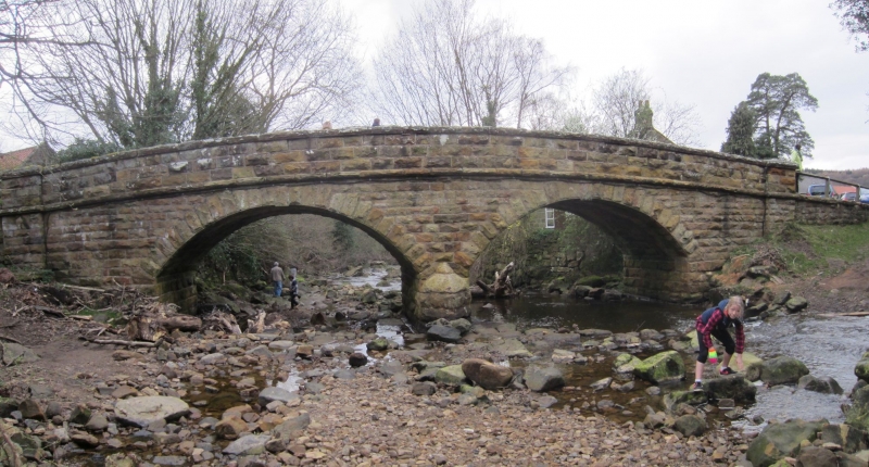
GOATHLAND BECK HOLE NZ8202-8302 19/86 Bridge over the Eller Beck GV II Bridge. C19. Rusticated sandstone. Two semicircular arches of voussoirs with cutwaters on both sides of centre pier. Pilaster piers at each end rising through plain parapet over moulded band. Parapet slightly raked with cambered coping. Flat caps to piers. Included for group value.
Listing NGR: NZ8216602231
External links are from the relevant listing authority and, where applicable, Wikidata. Wikidata IDs may be related buildings as well as this specific building. If you want to add or update a link, you will need to do so by editing the Wikidata entry.


Other nearby listed buildings