Approximate Location Map
Large Map »
Latitude: 54.1365 / 54°8'11"N
Longitude: -1.5188 / 1°31'7"W
OS Eastings: 431536
OS Northings: 471290
OS Grid: SE315712
Mapcode National: GBR KNTL.ZY
Mapcode Global: WHC7V.M9Y7
Plus Code: 9C6W4FPJ+HF
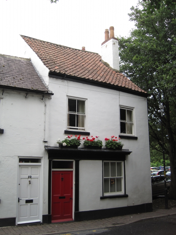
Entry Name: 21, St Marygate
Listing Date: 12 October 1977
Grade: II
Source: Historic England
Source ID: 1174619
English Heritage Legacy ID: 330208
ID on this website: 101174619
Location: Ripon, North Yorkshire, HG4
County: North Yorkshire
District: Harrogate
Civil Parish: Ripon
Built-Up Area: Ripon
Traditional County: Yorkshire
Lieutenancy Area (Ceremonial County): North Yorkshire
Church of England Parish: Ripon Cathedral Parish with Littlethorpe
Church of England Diocese: Leeds
Tagged with: Building
SE 3171 RIPON ST MARYGATE
1/64 (west side)
12.10.77
No 21
GV
II
C18 or early C19. Stucco. Pantiled roof. Two storeys. Two bays: sashes. Door with
4 moulded panels and oblong fanlight : 2 wooden Tuscan pilasters. Moulded cornice
linking door and ground floor window.
Listing NGR: SE3153671290
External links are from the relevant listing authority and, where applicable, Wikidata. Wikidata IDs may be related buildings as well as this specific building. If you want to add or update a link, you will need to do so by editing the Wikidata entry.


Other nearby listed buildings
