Approximate Location Map
Large Map »
Latitude: 54.1363 / 54°8'10"N
Longitude: -1.526 / 1°31'33"W
OS Eastings: 431067
OS Northings: 471264
OS Grid: SE310712
Mapcode National: GBR KNSM.F0
Mapcode Global: WHC7V.J9KD
Plus Code: 9C6W4FPF+GJ
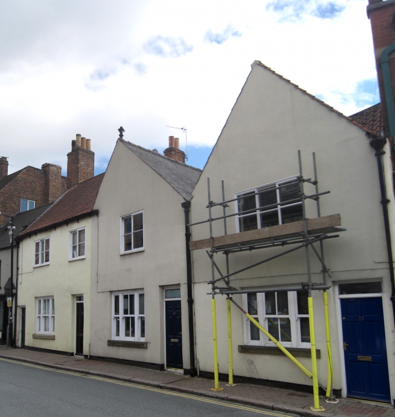
Entry Name: 17, 18 and 19, Westgate
Listing Date: 6 May 1970
Grade: II
Source: Historic England
Source ID: 1174796
English Heritage Legacy ID: 330236
ID on this website: 101174796
Location: Ripon, North Yorkshire, HG4
County: North Yorkshire
District: Harrogate
Civil Parish: Ripon
Built-Up Area: Ripon
Traditional County: Yorkshire
Lieutenancy Area (Ceremonial County): North Yorkshire
Tagged with: Building
SE 3171 RIPON WESTGATE
1/109 (south side)
6.5.70
Nos 17, 18 and 19
GV
II
Probably C17. Front modern rendering with applied timber-framing. Rear brown brick.
Pantile, stone slate and tile roof. Two storeys. Front has 4 bays, 2 gables.
Listing NGR: SE3106771264
External links are from the relevant listing authority and, where applicable, Wikidata. Wikidata IDs may be related buildings as well as this specific building. If you want to add or update a link, you will need to do so by editing the Wikidata entry.


Other nearby listed buildings
