Latitude: 54.1104 / 54°6'37"N
Longitude: -0.5775 / 0°34'39"W
OS Eastings: 493093
OS Northings: 469216
OS Grid: SE930692
Mapcode National: GBR SNDX.R9
Mapcode Global: WHGCQ.3Y88
Plus Code: 9C6X4C6C+5X
Entry Name: Footbridge, Lychgate and Attached Churchyard Wall to Church of St Mary
Listing Date: 14 December 1987
Grade: II
Source: Historic England
Source ID: 1175034
English Heritage Legacy ID: 329374
ID on this website: 101175034
Location: West Lutton, North Yorkshire, YO17
County: North Yorkshire
District: Ryedale
Civil Parish: Luttons
Traditional County: Yorkshire
Lieutenancy Area (Ceremonial County): North Yorkshire
Church of England Parish: Luttons Ambo, East and West St Mary
Church of England Diocese: York
Tagged with: Footbridge
SE 93 NW
13/34
LUTTONS
MAIN STREET
(north side)
West Lutton
Footbridge, Lychgate and attached churchyard wall to Church of St Mary
GV
II
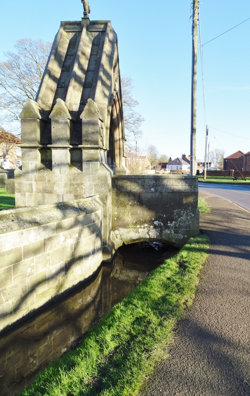
Footbridge, lychgate and chuchyard wall. 1875. By G E Street for Sir
Tatton Sykes. Sandstone ashlar; wrought-iron gates. Footbridge: single
chamfered segmental arch; plain parapet with sloped coping and roll-moulded
ridge. Lychgate: gabled gateway with 2-centred moulded arch beneath rolled
hoodmould. Low-relief saltire crosses in square surrounds on each side of
arch and carved cypher in circular surround above. Roll-moulded gable
coping and crocket wheel cross. Returns: 3 gabled buttresses. Interior: 3
transverse moulded ribs. Wall: low wall with sloped buttresses, sloping and
roll-moulded coping.
Listing NGR: SE9309369216
External links are from the relevant listing authority and, where applicable, Wikidata. Wikidata IDs may be related buildings as well as this specific building. If you want to add or update a link, you will need to do so by editing the Wikidata entry.


Other nearby listed buildings